Search For Maps & Articles

Showing posts sorted by relevance for query speed camera locations. Sort by date Show all posts

What Is the Status of Los Angeles’ New Speed Cameras? 2026 Update

What Is the Status of Los Angeles’ New Speed Cameras? 2026 Update

Los Angeles is preparing for one of the biggest expansions of automated speed enforcement in California history. The city has approved 125 speed safety camera locations across Los Angeles, but drivers may be wondering: Are LA’s new speed cameras active yet, and are they issuing tickets?

As of September 2026, the Los Angeles Department of Transportation (LADOT) is moving forward with its new Speed Safety System Program, authorized under California Assembly Bill 645. The cameras are scheduled to be deployed at 125 locations across the city, with an emphasis on streets with histories of speeding, serious crashes, schools, senior centers and other areas where pedestrians may be particularly vulnerable.

However, the rollout has taken longer than originally expected. Earlier LADOT announcements anticipated the first systems coming online around August 2026. LADOT's current program information describes the launch more broadly as occurring in late summer/fall 2026.

That means Los Angeles drivers should expect to see these cameras appearing on city streets, but an installed camera does not necessarily mean that drivers are immediately receiving speeding tickets.

Are Los Angeles Speed Cameras Active Yet?

Los Angeles' automated speed camera program is now in the implementation phase.

The Los Angeles City Council has approved the program and its 125 locations, and the city has selected a vendor to deploy and operate the system. LADOT says the Speed Safety Systems Program is launching in late summer or fall 2026.

The important distinction for drivers is between a camera being installed, a camera being activated, and a camera beginning paid citation enforcement.

California law and Los Angeles' implementation plan require a warning period before a newly activated location begins issuing monetary citations. LADOT says each camera location will have a 60-day warning period, during which motorists who trigger the system receive warnings instead of fines.

So even after drivers begin seeing cameras installed along Los Angeles streets, tickets will not necessarily begin immediately.

Why Has the Los Angeles Speed Camera Rollout Been Delayed?

Los Angeles initially expected to move more quickly.

In June, LADOT said the first speed safety systems were scheduled to come online around the beginning of the school year in August. In early July, the department similarly said activation of the first systems was planned by the end of August.

By the end of July, however, reports indicated that none of the planned 125 cameras had yet been installed, despite an earlier timeline calling for installation and testing by July.

LADOT's current public-facing information no longer gives a specific August activation date. Instead, it says the program is launching in late summer/fall 2026.

The project's overall implementation is nevertheless moving forward. The City Council approved the locations, impact report and use policies, and the city awarded the automated enforcement contract during 2026.

Los Angeles Has Approved 125 Speed Camera Locations

The scope of the LA speed camera program is significant.

Los Angeles plans to deploy speed safety systems at 125 locations across the city. The locations are spread across all 15 Los Angeles City Council districts.

LADOT selected corridors based on factors including speeding, speed-related crashes and the presence of vulnerable road users. Locations near schools, senior centers and other areas with significant pedestrian activity were also considered.

The cameras will appear on well-traveled streets throughout Los Angeles, including corridors such as:

  • Olympic Boulevard

  • Venice Boulevard

  • Figueroa Street

  • Vermont Avenue

  • Western Avenue

  • La Cienega Boulevard

  • Victory Boulevard

  • Sherman Way

  • Reseda Boulevard

  • Sunset Boulevard

  • Gaffey Street

  • Ventura Boulevard

Drivers should understand that LADOT generally identifies the approved locations as roadway segments rather than a single intersection.

According to LADOT's program documents, these segments can range from approximately 0.5 to 3 miles long. Cameras can then be positioned on existing city infrastructure within the approved segment.

This is important when looking at an LA speed camera map because a camera may not necessarily be located at the intersection most commonly associated with the corridor.

How Fast Do You Have to Drive to Get an LA Speed Camera Ticket?

The Los Angeles speed cameras are not designed to issue citations for driving just one or two miles per hour over the posted limit.

LADOT says the automated systems will capture vehicles traveling at least 11 mph over the posted speed limit. The system captures the vehicle's rear license plate information, which is then used to process the violation.

For example, on a road with a posted 35 mph speed limit, automated enforcement would begin at 46 mph.

That 11-mph threshold is one of the most important details for Los Angeles drivers to understand about the new program.

How Much Is a Los Angeles Speed Camera Ticket?

Los Angeles speed camera violations will be civil violations rather than criminal offenses.

LADOT says citations start at $50 for driving 11 to 15 mph above the posted speed limit. Unlike a traditional moving violation issued by a police officer, these automated speed-camera violations do not add points to a California driver's license.

The amount increases for higher speeds.

Drivers should also watch for signs when approaching camera-enforced areas. LADOT's policy requires "Photo Enforced" signage along with the posted speed limit before an automated enforcement location.

Will There Be a Warning Before LA Speed Camera Tickets Begin?

Yes.

This may be the most important part of the rollout for drivers.

Each newly activated Los Angeles speed camera location must go through a 60-calendar-day warning period. During that period, drivers who exceed the enforcement threshold receive a warning notice rather than a monetary citation.

After the warning period expires, the camera can begin issuing actual civil violations.

Because cameras may not all become operational on exactly the same day, drivers should not assume that every one of the 125 locations will transition from warnings to citations simultaneously.

The enforcement status of individual locations may therefore become particularly important as the rollout progresses.

Who Is Operating Los Angeles' Speed Cameras?

Los Angeles selected Verra Mobility to help deploy and operate the automated speed enforcement program.

The Los Angeles City Council approved the contract in June 2026. The agreement authorizes the company to design, install, operate and maintain the automated speed camera system. The contract has a maximum value of approximately $38.4 million and extends into 2032.

Verra Mobility said in June that the 125 locations were expected to be operational by the end of 2026.

That end-of-year target is particularly notable given the slower-than-originally-expected summer rollout.

Why Is Los Angeles Installing Speed Cameras?

Los Angeles says the program is primarily a traffic-safety initiative.

According to LADOT, approximately one in five fatal crashes in Los Angeles in 2024 was directly attributed to speeding. The department says automated enforcement is intended to reduce excessive and chronic speeding and ultimately reduce serious injuries and deaths.

The city is implementing the cameras under California Assembly Bill 645, which established a pilot program allowing several California cities to use automated speed enforcement.

Los Angeles is one of the cities authorized to participate.

Under the state framework, the cameras are restricted to qualifying areas such as school zones, designated safety corridors and certain locations with documented speeding problems.

The program is a pilot rather than permanent statewide authorization. LADOT says it will evaluate the program after the five-year pilot period and report on its safety and economic effects.

What Information Do the LA Speed Cameras Collect?

Privacy has been one of the major questions surrounding automated traffic enforcement.

According to LADOT, the speed safety systems are designed to capture the rear license plate of vehicles exceeding the enforcement threshold. The city says the program does not collect personally identifiable information beyond what is necessary to process violations.

LADOT's policies also contain data-retention and deletion requirements.

This is different from the network of automated license plate reader cameras used for law-enforcement purposes. Los Angeles' new Speed Safety System is specifically intended to identify vehicles exceeding the speed threshold and process civil speeding violations.

When Will Los Angeles Speed Cameras Start Issuing Tickets?

There isn't one simple citywide ticket-start date.

The most accurate answer as of September 21, 2026 is that LADOT says the Speed Safety System Program is launching in late summer/fall 2026, while the city's contractor has said the 125 locations are expected to be operational by the end of 2026.

Once a particular system is activated, it must complete its 60-day warning period before monetary citations begin.

That makes the status of each individual camera important.

A camera may be:

Approved → Installed → Testing → Warning Only → Issuing Citations

Drivers should therefore verify the current enforcement status rather than assuming that simply seeing a camera means it is already issuing $50 or higher tickets.

Los Angeles Speed Camera Map: We’ll Add Locations as They Become Available

As Los Angeles begins installing and activating its new speed cameras, PhotoEnforced.com will add the confirmed LA speed camera locations to our map as they become available.

Because the city has approved roadway segments rather than publishing the precise placement of every individual camera in advance, the exact locations may become known gradually as equipment is installed and activated.

We plan to track the rollout and update our map with confirmed camera locations and other available enforcement information so Los Angeles drivers can see where the new speed cameras are located.

Subscribe to PhotoEnforced.com to stay tuned for updates as new Los Angeles speed camera locations become available.

Bottom Line: LA Speed Cameras Are Coming, but the Rollout Is Still Underway

Los Angeles' new speed-camera program is no longer just a proposal.

The City Council has approved 125 locations, LADOT has established the rules for operating the program, and a vendor has been selected to deploy the technology. However, implementation has moved more slowly than some of the city's earlier 2026 timelines anticipated.

As of September 2026, LADOT describes the program as launching in late summer/fall 2026. Once each camera is activated, drivers will receive warnings for 60 days before monetary citations begin.

The basic rules are straightforward:

125 approved locations.
11+ mph over the speed limit triggers the system.
60 days of warnings before citations.
Fines start at $50.
Violations are civil and do not add driver's-license points.

For Los Angeles drivers, the biggest question is therefore shifting from "Are speed cameras coming?" to "Where exactly are the cameras, which ones are active, and when does ticketing begin?"

PhotoEnforced.com will continue monitoring the rollout and adding confirmed Los Angeles speed camera locations to our map as they become available. Subscribe to stay tuned for the latest LA speed camera locations and enforcement updates.
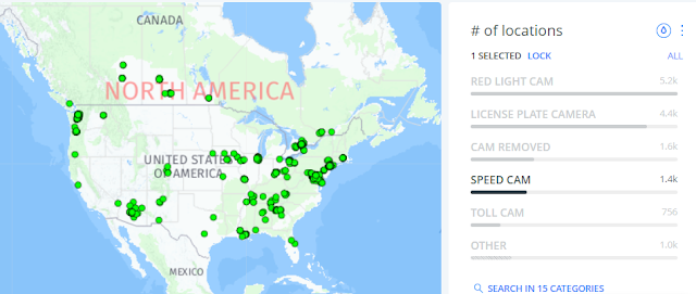
Are Speed Cameras Legal?

speed camera locations map
Speed regulation is mostly the responsibility of state and local governments. Traditionally, the federal government's responsibility has been to accumulate speed-trend and safety information, undertake and coordinate research, fund national highway and safety programs, and regulate new vehicle standards. There are two notable exceptions.

• From 1942 to 1945, the War Department ordered a nationwide speed limit of 35 mph to conserve rubber and gasoline for the war effort.

• In 1973 during the oil embargo, Congress enacted the National Maximum Speed Limit, set at 55 mph, to conserve fuel.

The NMSL was repealed by Congress in 1995, ending Federal penalties for noncompliance as well as the obligation for states to provide speed compliance statistics. States and communities have demonstrated increased interest in discovering better ways to efficiently manage speeds and minimize speeding-related crashes in the years since the repeal.

Since the NMSL's repeal, the federal government's role has evolved from NMSL compliance and enforcement to conducting research and providing recommendations in support of state and local highway safety programs, as well as providing science-based countermeasures and technical guidance for reducing speed.

The most popular approach for controlling speed is to set speed restrictions. In the 1920s and 1930s, the current framework for setting speed limits was devised. Every state has a basic regulation requiring drivers to travel at speeds that are acceptable and prudent in light of the current environment. State statutes establish speed restrictions that apply to a variety of road types and geographic areas. State and most municipal governments, on the other hand, have the right to establish speed zones for highway portions if statutory restrictions do not meet specific road or traffic conditions based on engineering studies.

In speed zones, speed restrictions are set for ideal conditions such as good weather, free-flowing traffic, and good visibility. As conditions change or deteriorate, drivers are expected to reduce their speeds. The most common approach is to set the limit based on an engineering study that considers factors like free-flowing vehicle operating speeds, crash experience, roadside development, roadway geometry, and parking and pedestrian activity levels to determine what speed the posted limit should be set at. When systems for setting speed limits are perceived as subjective and poorly understood, pressure from the public or elected authorities to lower speed restrictions is prevalent and difficult to resist.Speed management is a highly localized issue, with States and towns having the freedom to choose the right balance of risk and mobility.

Here are list of communities across the United States have implemented speed safety camera enforcement. Examples of these successful programs include: 

Auburn, WA has speed and red light safety camera locations.

Baltimore, MD  has speed and red light safety camera locations.

Denver, CO has speed and red light safety camera locations.

Chicago, IL - has lots of speed and red light camera safety camera locations.

Cedar Rapids, IA - has speed safety camera locations.

Chattanooga, TN - has speed safety camera locations.

Dayton, OH - has speed safety camera locations.

Montgomery County, MD experienced a 59% decrease in the likelihood of a driver exceeding the speed limit by more than 10 mph and reported a reduction in fatal or incapacitating injuries by 49% on roads with speed safety cameras.

New York City, NY speed cameras are only allowed in designated school zones, which encapsulate a quarter-mile radius of school buildings. The current law — an expansion of a school-zone camera program implemented in 2013 and expanded in 2019 — is set to expire in 2022

New Orleans, LA - has speed and red light camera safety camera locations.

Portland, OR reported a 46% reduction in traffic fatalities from an average of 56.8 annual traffic deaths before the program's implementation to an average of 30.5 traffic related deaths as the program has grown. Average and 85th percentile speeds also declined at speed safety camera locations. There was 85% decrease in the number of drivers exceeding the speed limit by 10 mph or more

Providence, RI - has speed safety camera locations

Seattle, WA had an overall calming effect on the city reporting a 4% reduction in the average speed of a speeding violation in miles per hour above the posted speed limit

Washington, D.C. experienced a 73% reduction in traffic fatalities, a decrease from 71 deaths in 2001 to 19 deaths in 2012 and a 34% decrease in traffic related injuries. Whereas one in three drivers were travelling 10 mph above the speed limit, when cameras were introduced the rate of speeders dropped to just one in 40 drivers.

Chicago Speed Camera Locations: Where Are They?

If you're driving in Chicago, you're bound to come across speed cameras. As part of the city’s automated traffic enforcement program, these cameras are designed to reduce speeding near parks and schools — and they've become a growing concern for both residents and commuters. Whether you're trying to avoid a ticket or just want to know where enforcement is most active, understanding the locations of Chicago speed cameras can help you stay informed and safe on the road.  

Why Chicago Uses Speed Cameras

Chicago first implemented speed cameras in 2013 under the rationale of increasing pedestrian safety. Cameras are typically placed near parks and schools, but enforcement has expanded significantly across the city. According to the Chicago Department of Transportation (CDOT), the goal is to encourage drivers to slow down — especially in areas with high foot traffic.

These cameras operate 24/7, and a single violation can result in fines ranging from $35 to $100, depending on the speed. The fine system is structured to penalize those driving 6 mph or more over the posted limit.

Interactive Map & Full Camera List

To view an interactive map of all current speed and red-light camera locations in Chicago, visit Chicago Speed Cameras Map, where our database is continuously updated.

Complete List of Chicago Speed Camera Locations

We’ve compiled a comprehensive and current list of over 250 speed camera locations throughout the city. These cameras monitor both directions unless otherwise noted. Here are just a few key areas:

  • Fullerton Ave – Multiple cameras at 5446, 5509, 6247, and 6250 W Fullerton monitoring EB/WB traffic

  • Western Ave – Coverage stretches from 4433 N to 7739 S Western

  • Pulaski Rd – Active monitoring at 5030, 4929, 5433, and 7826 S Pulaski

  • Ashland Ave – Cameras along both the North and South sides, including 3111 N and 8345 S

  • Irving Park Rd – Includes monitoring near 2705, 2712, 2501, and 5454 W Irving Park

To see the full, detailed list with exact addresses and directions (e.g., Northbound, Southbound, Eastbound, Westbound), check out our Chicago Speed Camera List.

Common Questions About Speed Cameras in Chicago

Are speed camera tickets enforceable?

Yes. They are considered civil violations and are enforceable by law. Unpaid tickets may lead to license suspensions or additional fines.

Can you fight a Chicago speed camera ticket?

Yes, but it requires submitting evidence or demonstrating an error (e.g., incorrect plate reading, vehicle stolen, etc.). Instructions are usually printed on the ticket.

How can I avoid speed camera tickets?

Use real-time traffic apps, stay updated with our camera map, and of course — follow the speed limits, especially in school zones and park areas.

Final Thoughts

Whether you're a city driver or an out-of-town visitor, being aware of Chicago’s speed camera locations can save you from unnecessary fines and encourage safer driving. As more cameras are added or relocated, staying informed is key.

Bookmark this page or check PhotoEnforced.com regularly for updates — and drive smart, Chicago.

Chicago Speed Camera Locations Where Are They

Singapore Traffic Police Keep Speed Camera Locations Confidential


The Singapore Traffic Police will be increasing penalties for specific offences in the latter part of the year due to growing concerns over the high number of speeding violations. Over 800 new offences were recorded in the first three weeks of April following the activation of speed enforcement on select red-light cameras. Although there are approximately 250 red-light cameras spread across the island, authorities have chosen not to disclose which ones have had their speed enforcement function activated or their exact locations. The number of speeding-related fatal accidents in 2023 rose by more than 80% compared to the previous year.

Singapore Does Not Release Active Speed Camera Locations

Map of Baltimore, Maryland School Speed Camera Locations

Baltimore City and Baltimore County have installed numerous school zone speed cameras to improve student safety and promote responsible driving. These automated systems are placed strategically near schools to deter speeding and reduce accidents.  Here is a map of Baltimore Speed Camera and Red Light Camera Locations

📍 Baltimore City School Zone Speed Camera Locations

Baltimore City's Automated Traffic Violation Enforcement System (ATVES) operates both fixed and portable speed cameras. These cameras are active Monday through Friday, from 6:00 AM to 8:00 PM, all year round. Drivers going more than 12 mph over the speed limit in these zones can expect a $40 fine (no points assessed to their license).

Recent Additions:

  • Belair Road (3700–4800 blocks): Near The Green School of Baltimore and Belair-Edison School

  • Hamilton Avenue (4500–4800 blocks): Serves Hazelwood Elementary/Middle School

  • Echodale Avenue (3600–3900 blocks): Close to Arts & Ideas Sudbury School and Gardenville Elementary

  • Hillen Road (5000–5300 blocks): Near Northwood Elementary School

  • Belair Road (6000–6200 blocks): Serves Glenmount Elementary/Middle School and City Neighbors Charter School

  • W. Franklin Street (2100 block): Close to Mary Ann Winterling Elementary School

  • Mt. Royal Terrace (2200 block): Covers nearby educational institutions

Other Notable Locations Include:

  • Gwynns Falls Parkway (2300 block)

  • Edmondson Avenue (4400 block)

  • Walther Avenue (5900 block)

  • Loch Raven Boulevard (3400 block)

  • Reisterstown Road (2800 and 3900 blocks)

  • Belair Road (2400 and 6000 blocks)

  • Liberty Heights Avenue (3100 and 3800 blocks)

  • North Charles Street (5000 block)

  • Northern Parkway (600 block)

  • E. Cold Spring Lane (1500 block)

  • Park Heights Avenue (multiple segments)

  • Wabash Avenue (5300–5500 blocks)

  • E. Pratt Street (1000–1100 blocks)

  • Roland Avenue (5000 block)

  • and many others across the city

Note: For a complete and current list, visit the Baltimore City Department of Transportation.

📍 Baltimore County School Zone Speed Camera Locations

Baltimore County also operates speed cameras in various school zones, with enforcement hours Monday through Friday, 6:00 AM to 8:00 PM. A $40 citation is issued to drivers going 12 mph or more over the speed limit. These measures are in place year-round, including during school breaks.

Newly Activated Locations (2024):

  • Cromwell Valley Elementary School: 900 block of Providence Road

  • Lyons Mill Elementary School: 4300 block of Owings Mills Boulevard

  • Franklin High School: 100 block of Franklin Boulevard

  • Pretty Boy Elementary School: 19800 block of Middletown Road

  • Redeemer Classical Christian School: 6400 block of Mount Vista Road

Additional New Locations (2025):

  • Belle Grove Elementary School — Brooklyn Park

  • Linthicum Elementary School — Linthicum Heights

  • School of the Incarnation — Gambrills

  • Van Bokkelen Elementary School — Severn

  • Benfield Elementary School — Severna Park

  • Marley Middle School — Glen Burnie

For the most updated list of Baltimore County speed camera locations, check the Baltimore County Government’s website.

⚖️ Speed Camera Enforcement Details

  • Active Days: Monday through Friday

  • Active Hours: 6:00 AM to 8:00 PM

  • Violation Threshold: 12+ mph over the limit

  • Fine Amount: $40

  • Points on License: None

  • Warning Period for New Cameras: 30 days (typically)

🛡️ The Safety Impact

The school zone camera program is designed to:

  • Increase pedestrian safety for students, families, and staff

  • Curb dangerous speeding habits in high-traffic zones

  • Reduce collisions and injuries in school areas

New cameras near Belair Road and other zones were installed in response to pedestrian fatalities, reinforcing the program’s role in saving lives.

🔗 Stay Informed

Map of Baltimore, Maryland School Speed Camera Locations

Coconut Creek, Florida School Zone Speed Camera Locations Map


Coconut Creek, FL, has implemented automated school speed zone cameras to improve safety for children and reduce speeding violations near schools. If you're a resident or commuter in the area, understanding where these cameras are and how they operate can help you avoid fines and keep the community safer.  Here is a map of speed cameras in Florida

What Are School Speed Cameras?

Why Are Mapping Companies Afraid to Publish Camera Locations?

black, red, yellow country shape 

In an age where real-time traffic updates, satellite imagery, and AI-powered routing are commonplace, one question stands out: Why do most mapping companies avoid showing speed and red-light camera locations? With drivers increasingly reliant on navigation apps like Google Maps, Apple Maps, and Waze, the lack of transparency around traffic enforcement camera locations raises serious concerns about data censorship, user trust, and government influence.

The Growing Demand for Camera Location Transparency

Speed and red-light cameras are now widespread across major U.S. cities—from New York to Chicago to Los Angeles. These cameras are marketed as tools to improve public safety by deterring dangerous driving behaviors. But many critics argue they're also a revenue-generating tool for municipalities.

For drivers, knowing the location of speed and red-light cameras isn't just about avoiding tickets—it's about making informed driving decisions. That’s why demand for apps and websites that publish camera locations has skyrocketed. So why aren’t the biggest names in mapping fully supporting this?

1. Legal and Regulatory Pressure

Mapping giants operate globally, which means they face a complex patchwork of local laws and regulations. In some countries, publishing the location of speed enforcement cameras is outright banned. Even in the U.S., some jurisdictions have lobbied against features that reveal camera locations, arguing it undermines public safety efforts.

Is It Illegal in Germany and Europe?

Yes—and this is a major reason mapping companies remain cautious.

In Germany, it is illegal to use or operate apps or devices that provide real-time speed camera alerts while driving. Section 23(1c) of the German Road Traffic Act prohibits using such functionality in vehicles, and violators face fines and points on their license. Passive knowledge (like memorizing camera locations or checking before the drive) is allowed—but live alerts during driving are banned.

Here’s a snapshot of laws in Europe:

Country Legal to Use Speed Camera Alerts While Driving?
Germany ❌ Illegal
France ❌ Illegal (workarounds like "danger zones" used)
Switzerland ❌ Very illegal—even owning the app
UK ✅ Legal for fixed cameras
Netherlands ✅ Generally allowed
Italy/Spain ✅ Mixed enforcement

Because mapping companies often deploy uniform global features, they tend to restrict or blur enforcement camera data in countries with strict laws—sometimes impacting their features even in more lenient regions.

2. Fear of Political and Governmental Backlash

Publishing camera locations can put tech companies at odds with local governments and law enforcement agencies. These partnerships are often essential for access to infrastructure data, transit updates, and emergency response systems.

Criticizing or circumventing traffic enforcement tools might jeopardize those relationships. For some companies, avoiding conflict with city governments is more important than serving driver interests.

3. Liability and Public Safety Concerns

Mapping companies must also weigh ethical concerns. Critics of camera alerts argue that making camera data widely available could encourage reckless driving—drivers might only slow down near known camera points and speed elsewhere.

This puts companies in a tough position: if someone misuses the information and causes harm, could the platform be held partially responsible? To avoid these murky liability waters, many simply choose not to include real-time camera data.

4. Data Sourcing Challenges

Another overlooked factor is data reliability. Camera installations frequently change—new ones are added, and older ones are decommissioned or relocated. Maintaining an accurate, up-to-date global database of camera locations is a monumental task that requires constant local data verification.

Crowdsourced platforms like Waze have made strides in this area, but even then, accuracy varies widely by location. This makes it hard for major players to justify large-scale implementation, especially if the data can't be verified.

5. The Rise of Independent Alternatives

With mainstream mapping tools reluctant to offer full camera visibility, independent websites and apps are stepping in to fill the gap. Platforms like Speedtrap.org, PhotoEnforced.com, and various Reddit forums crowdsource camera location data and provide regularly updated maps.

Conclusion: Transparency vs. Control

At the heart of the issue is a clash between driver autonomy and centralized control. Mapping companies may cite safety, compliance, and legal complexity as reasons to hide traffic camera data, but users are growing increasingly skeptical. In a digital era built on open data and real-time insights, the decision to withhold information feels outdated—and potentially manipulative.

If companies like Google and Apple want to maintain user trust, it might be time to embrace camera transparency and let drivers make informed choices.

Queensland, Australia Is Increasing Speeding & Red Light Fines

Queensland Australia speed camera sign

The penalties are as follows:

OffensePenalty
1-10km/h over the speed limit$287 and one demerit point
11-20km/h over the speed limit$431 and three demerit points
21-30km/h over the speed limit$646 and four demerit points
31-40km/h over the speed limit$1078 and six demerit points
Over 40km/h above the speed limit$1653, eight demerit points, and a six-month license suspension
Running a red light$575 and three demerit points

The number of road safety cameras continues to increase in Queensland, and they’ve been busy in the last 12 months.

Based on the number of infringement notices issued, the top five fixed and mobile speed camera locations are all located in the most populous part of the state, the south-east, and all but one is located in Brisbane.

As of March 2022, Queensland’s camera network includes the following:

  • 21 fixed speed cameras
  • 48 fixed speed and red light camera locations
  • 113 fixed red light cameras
  • 9 point-to-point cameras

The history of crashes in a location is a major determining factor in where speed cameras are deployed.

The Department of Transport and Main Roads looks at the number and severity of crashes within a five-year period and conducts risk analysis, providing the data to the Queensland Police Service.

Other factors that influence where a speed camera is placed include areas where motorists commonly exceed the speed limit or run red lights, and where road workers, pedestrians and other road users are vulnerable.

The Queensland Government says at least two speed-related crashes need to have occurred in an area in the past five years for the location to be chosen for mobile speed camera enforcement.

The Queensland Government also advises there are 3038 active mobile camera sites and 485 parked mobile camera sites.


We contacted the Department of Transport and Main Roads to find out which locations racked up the most offenses.

Below is a list of the top five fixed locations in 2021 by the number of infringement notices issued:

LocationTypeNumber of notices issued
Pacific Motorway, LoganholmeSpeed16,295
Intersection of Mt Gravatt-Capalaba Road and Gateway Motorway, MacKenzieRed light and speed14,440, including 396 red light notices
Intersection of Smith Street and Kumbari Avenue, SouthportRed light and speed13,881, including 151 red light notices
Main Street, Kangaroo PointSpeed13,694
Intersection of Lutwyche Road and Kedron Park Road, KedronRed light and speed12,824, including 578 red light notices

Many of these locations also appeared in our 2020 round-up, and most had a fairly similar number of notices issued.

The first-place finisher for 2021, however, was off by 12,227 notices issued compared to the location with the most issued in 2020.

The top five mobile locations were:

LocationNumber of notices issued
Hale Street, Petrie Terrace/Paddington11,213
Ipswich Road, Annerley8432
Southern Cross Way, Eagle Farm4967
Mt Gravatt-Capalaba Road, Upper Mount Gravatt4139
Herston Road, Kelvin Grove4078

Double demerit points apply if you are caught exceeding the speed limit by more than 21km/h more than twice during a 12-month period.

Here are Queensland's top-earning speed cameras in 2021

For another year, Hale Street was the number one mobile location, though by not quite as large a margin as in 2020.

Located on an extension of Brisbane’s Inner City Bypass (ICB), the combination of a downhill slope and a lower speed limit than the rest of the ICB manages to catch out thousands of inattentive drivers.

From July 1, 2022, the Queensland Government is increasing speeding fines.

It’s also changing some of the thresholds, with the first bracket changing to 1-10km/h instead of 1-12km/h over the speed limit, and the second bracket changing to 11-20km/h from 13-20km/h.

SF Speed Camera Locations: Where They Are They?

San Francisco has recently rolled out new speed cameras in an effort to improve road safety and reduce speeding across the city. If you're driving in the city, it's essential to know where these cameras are located and how much speeding tickets could cost you. Below is a comprehensive guide to San Francisco speed camera locations, their operational status, and the fines associated with violations.  Here is another map of San Francisco speed cameras.  

Why Speed Cameras Matter

Do Flock Cameras Track Speed? What Drivers Need to Know

Do Flock Cameras Track Speed? What Drivers Need to Know

If you have noticed a small solar-powered camera mounted along a road, near an intersection, or at the entrance to a neighborhood, there is a good chance you may have seen a Flock Safety camera. These cameras have become increasingly common across the United States as police departments, cities, homeowners associations, and businesses use automated license plate recognition technology to identify vehicles.

Their growing presence has also created an important question for drivers:

Do Flock cameras track speed?

The short answer is generally no — standard Flock Safety license plate reader cameras are not speed cameras and are not designed to issue speeding tickets.

However, the answer has become slightly more complicated because Flock Safety also offers traffic analytics technology capable of producing aggregate speed statistics. That does not mean the camera can identify you individually as speeding or automatically send you a speeding ticket.

Understanding the difference between a Flock license plate reader, a traffic analytics system, and an actual automated speed enforcement camera can help drivers understand exactly what these devices are doing along the road.

Do Flock Cameras Detect Speed?

According to Flock Safety, its standard license plate recognition cameras do not have speed detection capabilities.

Flock's primary license plate reader technology is designed to capture information about vehicles passing a particular location. It is not designed to function like a radar gun or automated speed camera.

A typical Flock license plate reader can capture information such as:

  • License plate number

  • License plate state

  • Vehicle image

  • Vehicle make or model characteristics

  • Vehicle color

  • Date and time

  • Camera location

  • Other visible vehicle characteristics

This information can then be made searchable for authorized users, such as participating law enforcement agencies.

That means a Flock camera might record that a particular vehicle passed a camera at a certain location and time, but that does not automatically mean the system recorded how fast that individual vehicle was traveling.

Can a Flock Camera Give You a Speeding Ticket?

A standard Flock license plate reader cannot issue you a speeding ticket simply because you drive past it too fast.

This is an important distinction because Flock cameras can sometimes resemble other types of roadside traffic cameras.

Traditional automated speed enforcement systems typically require technology capable of measuring the speed of an individual vehicle. Depending on the system, that may involve radar, lidar, roadway sensors, or calculations based on vehicle movement.

The system then associates the measured speed with photographic evidence identifying the offending vehicle.

Flock's standard automated license plate readers operate differently. Their primary purpose is identifying and categorizing vehicles rather than enforcing speed limits.

Therefore, seeing a Flock camera on a pole does not necessarily mean you are approaching a speed trap or automated ticketing location.

But Can Flock Measure Traffic Speed?

This is where the answer becomes more nuanced.

Flock Safety now offers Traffic Analytics, a product intended for transportation departments, municipalities, and other government agencies that want to understand traffic patterns.

According to Flock, Traffic Analytics can provide aggregate speed information about groups of vehicles.

For example, transportation officials may be able to see measurements including:

  • Average vehicle speed

  • 85th percentile speed

  • Pace speed

  • Speed differential

  • Percentage of traffic exceeding the posted speed limit

However, Flock says these speed observations are grouped into 15-minute intervals rather than stored as the speed of a specific vehicle.

In other words, the system might tell transportation planners that vehicles traveling along a particular road between 8:00 and 8:15 a.m. had an average speed of 42 mph.

It is not supposed to tell them:

"The blue Honda with license plate ABC123 was traveling 47 mph."

That distinction is extremely important.

Flock states that its Traffic Analytics speed statistics cannot identify individual drivers and cannot be used for individual speed enforcement.

Why Would Flock Measure Speed If It Doesn't Issue Tickets?

Speed information has many uses beyond traffic enforcement.

Transportation departments routinely conduct traffic studies to determine how roads are being used. Historically, this sometimes required temporary equipment such as pneumatic tubes stretched across a roadway or personnel manually observing traffic.

Traffic analytics technology can automate some of that process.

For example, a city might discover that the posted speed limit on a residential street is 25 mph but traffic routinely travels significantly faster.

Officials could potentially use that information when considering:

  • Speed humps

  • Traffic signals

  • Stop signs

  • Road diets

  • Pedestrian crossings

  • Bike lanes

  • Lane redesigns

  • Increased police patrols

  • Changes to posted speed limits

Therefore, aggregate speed information can influence future traffic safety decisions even when it isn't being used to ticket individual drivers.

What Is a Flock Camera Actually Tracking?

Flock cameras are primarily associated with automated license plate recognition, commonly called ALPR or LPR technology.

When a vehicle passes a Flock camera, the system can capture an image of the vehicle and license plate.

Flock's published LPR policy says its LPR data can include the license plate image, vehicle image, vehicle characteristics such as color and make, plate number, plate state, date, time, and camera location.

That information can make it possible for authorized users to search for vehicles associated with investigations.

For example, police investigating a stolen vehicle may receive an alert when a license plate associated with that vehicle passes a participating camera.

The technology can also help investigators search for vehicles based on characteristics even when the complete license plate number isn't known.

Can Flock Cameras Track Where Your Car Goes?

A single Flock camera captures a vehicle when it passes that particular camera location.

If a vehicle passes multiple cameras, however, there may potentially be multiple observations showing the vehicle at different locations and times, subject to the particular network's access, sharing rules, retention policies, and applicable law.

This is one reason automated license plate reader networks have generated considerable privacy debate.

It is important, however, to distinguish location observations from continuous GPS tracking.

A Flock camera is not attaching a GPS tracker to your vehicle. It observes vehicles when they pass cameras within the system.

Think of it more like a series of checkpoints.

If your vehicle passes Camera A at 10:05 a.m. and another camera records it later, those are separate observations rather than a continuous GPS record of every turn you made between those locations.

Could Police Calculate Your Speed Between Two Flock Cameras?

Drivers sometimes wonder whether timestamps from two license plate readers could theoretically be used to calculate average speed.

Mathematically, average speed can be estimated if someone knows both the distance traveled and the elapsed time.

For example, if a vehicle traveled exactly 10 miles between two known points in 10 minutes, its average speed would be approximately 60 mph.

But that theoretical calculation is very different from an automated speed enforcement system.

There may be multiple routes between cameras, differences in actual distance traveled, stops along the way, timestamp considerations, and legal requirements governing how speeding violations must be measured and documented.

Flock's current position is that its products cannot be used for individual speed enforcement.

Drivers should therefore not assume that two Flock cameras automatically function as an average-speed camera system.

Flock Camera vs. Speed Camera

Although they can look similar from the driver's perspective, Flock cameras and automated speed cameras serve different purposes.

A Flock license plate reader is primarily designed to answer questions such as:

What vehicle passed this location, and when?

A speed enforcement camera is designed to answer:

Was this specific vehicle exceeding the legally established speed limit?

A speed camera therefore needs reliable speed-measurement technology and typically must meet specific state or local requirements before evidence can be used to issue citations.

A Flock LPR camera is primarily an identification and investigative tool.

Flock Cameras vs. Red-Light Cameras

Flock cameras should also not automatically be confused with red-light cameras.

A red-light camera monitors an intersection and is designed to document vehicles that enter an intersection after a traffic signal has turned red.

Depending on the jurisdiction, a red-light enforcement system may photograph or record:

  • The vehicle

  • License plate

  • Traffic signal

  • Intersection

  • Stop line

  • Time elapsed after the red signal

A Flock camera, by comparison, generally focuses on vehicle identification rather than determining whether a traffic signal violation occurred.

A city could have Flock cameras and red-light cameras operating in the same general area, but they are different systems.

How Can You Tell If a Camera Is a Flock Camera?

Flock cameras are commonly installed on relatively small roadside poles and many installations use solar panels because the equipment can operate without being connected directly to conventional electrical infrastructure.

They may appear along:

  • Major roads

  • Neighborhood entrances

  • Shopping centers

  • Parking areas

  • Business districts

  • High-crime areas

  • Roads entering or leaving cities

Drivers sometimes mistake these installations for speed cameras because of their roadside positioning.

Appearance alone, however, should not be used to determine what type of enforcement system is operating.

Local governments and police departments may publish information identifying their automated license plate reader locations and policies.

Do Flock Cameras Use Radar?

Standard Flock LPR cameras should not be assumed to be radar-based speed enforcement devices.

Flock does have a broader transportation product line that can collect speed-related traffic data, but that is separate from saying an individual Flock LPR camera is operating as a police radar gun.

This distinction is particularly important as Flock expands beyond traditional license plate recognition into traffic and transportation analytics.

When someone asks, "Can Flock cameras detect speed?", the most accurate answer now depends on what they mean by "detect."

Can Flock technology produce aggregate traffic speed statistics?

Yes.

Can a standard Flock license plate reader identify your individual speed and automatically issue you a speeding ticket?

No, according to Flock's current product information.

Are Flock Cameras Speed Traps?

Generally, no.

A Flock camera located beside a road should not automatically be considered an automated speed trap.

Its primary function is likely license plate and vehicle recognition.

However, motorists should remember that the presence of one type of camera does not rule out other enforcement methods nearby. Police could still conduct conventional radar or lidar enforcement on the same roadway, and a jurisdiction could operate separate automated speed enforcement equipment where legally permitted.

Always follow the posted speed limit regardless of what type of camera you see.

The Bottom Line: Do Flock Cameras Track Speed?

So, do Flock cameras track speed?

For individual drivers, standard Flock Safety license plate reader cameras do not measure your speed for the purpose of issuing speeding tickets.

Flock's ALPR technology primarily records vehicle and license plate information associated with a particular place and time.

Flock does now offer Traffic Analytics technology capable of reporting aggregate speed statistics, including average and 85th-percentile speeds. However, Flock says those statistics are grouped across vehicles and cannot be associated with an individual vehicle for speed enforcement.

That means a Flock system may help a city determine that drivers are speeding on a particular road, but it is not designed to determine that you specifically were driving 47 mph in a 35-mph zone and automatically mail you a speeding ticket.

As traffic-camera technology continues to evolve, the distinction between license plate readers, traffic analytics systems, red-light cameras, and automated speed cameras is becoming increasingly important.

Before assuming that any roadside camera is issuing tickets, identify the type of system being used and check the automated enforcement laws and policies in that jurisdiction.

Waze Map for Photo Enforced Traffic Cameras: How It Compares

Waze, the community-based navigation app, has become a go-to tool for drivers worldwide, offering real-time information about road conditions, traffic, and even photo-enforced traffic cameras. Knowing where red light cameras, speed cameras, and other enforcement devices are can help drivers stay compliant and avoid fines. But how does Waze’s traffic camera reporting compare to dedicated databases like PhotoEnforced? Let’s explore the features, benefits, and differences to help you make an informed choice.

What Are Photo-Enforced Cameras on Waze? 

How to Identify Traffic Cameras in New Zealand

Identifying traffic cameras in New Zealand can be important for understanding traffic regulations, monitoring traffic flow, and ensuring safe driving practices. Here are some steps to identify traffic cameras in NZ: 

Red Light and Speed Camera Vendors in the U.S. – Who Operates Where?

red light camera locations by state

Red light and speed cameras play a significant role in traffic enforcement across the United States. While some advocate for their safety benefits, others raise concerns about their implementation. Central to this discussion are the private vendors responsible for these automated enforcement systems. This guide provides an overview of the top red light and speed camera vendors in the U.S. and highlights their areas of operation.

Top Red Light and Speed Camera Vendors in the U.S.

1. Verra Mobility

  • Headquarters: Mesa, Arizona

  • Markets Served: Over 500 cities across the U.S.

  • Notable Locations:Chicago, IL; New York City, NY; Orlando, FL; Seattle, WA

  • Services: Red light cameras, speed cameras, school bus stop-arm enforcement

Verra Mobility is a leading provider of smart mobility technology solutions. They offer comprehensive red-light safety solutions, including hardware, software, and services to capture violations. Their systems are designed to reduce red-light running and prevent crashes. Vera Mobility

2. Sensys Gatso Group

  • Headquarters: Jönköping, Sweden (U.S. offices in Beverly, Massachusetts)

  • Markets Served: 15+ U.S. states

  • Notable Locations: Albany, NY; Des Moines, IA; Miami-Dade County, FL

  • Services: Speed enforcement, red light cameras, automated traffic enforcement solutions

Sensys Gatso specializes in innovative traffic enforcement solutions. Their T-Series red light system enforces wide intersections with high detection and imaging accuracy, operating independently from traffic signal controllers. 

3. Rekor Systems

  • Headquarters: Columbia, Maryland

  • Markets Served: Expanding across multiple states

  • Notable Locations: Montgomery County, MD; various school zones in Georgia and Texas

  • Services: AI-powered vehicle recognition, speed enforcement, red light detection, license plate readers (LPR)

Rekor Systems offers advanced traffic data collection services, blending traditional techniques with AI-based approaches. Their solutions include AI-based video detection, radar detection, and portable traffic data collection methods.

4. Jenoptik

  • Headquarters: Jena, Germany (U.S. office in Jupiter, Florida)

  • Markets Served: Selected states in the U.S., especially in the Northeast and Florida

  • Notable Locations: Fort Lauderdale, FL; Maryland; Pennsylvania

  • Services: Speed enforcement, red light enforcement, smart city solutions 

Jenoptik provides comprehensive road safety solutions, including mobile, semi-stationary, and stationary speed enforcement systems. Their technology is designed to increase road safety by reducing speeding and red light violations. 

5. Redflex Traffic Systems

  • Headquarters: Formerly Phoenix, Arizona

  • Markets Served: Merged with Verra Mobility in 2021

  • Notable Locations (Pre-Merger): Los Angeles, CA; Newark, NJ; Chicago, IL

  • Services: Red light cameras, speed cameras, mobile enforcement

Redflex was a significant player in the traffic enforcement industry before its acquisition by Verra Mobility in 2021. The merger expanded Verra Mobility's reach and consolidated the market.

Where These Vendors Operate: State and City Breakdown

Here's a snapshot of where the major vendors have contracts:

City/State Vendor Camera Type
Chicago, IL Verra Mobility Speed & Red Light Cameras
New York City, NY Jenoptik Speed Cameras
Miami-Dade County, FL Sensys Gatso Red Light Cameras
Fort Lauderdale, FL Jenoptik Speed Cameras
Montgomery County, MD Rekor Systems School Zone Speed Cameras
Albany, NY Sensys Gatso Speed & Red Light Cameras
Des Moines, IA Sensys Gatso Speed Enforcement
Newark, NJ Verra Mobility (Redflex legacy) Red Light Cameras

Note: Camera vendor contracts may change due to new bids or legislation.

Controversy and Legal Challenges

Many cities have faced public backlash and lawsuits over automated enforcement. Common concerns include:

  • Accuracy and fairness of ticketing

  • Lack of due process for motorists

  • Revenue-sharing models between cities and vendors

  • Disproportionate placement in low-income neighborhoods

Some states have banned or heavily restricted the use of red light and speed cameras altogether, including Texas, New Hampshire, and Mississippi.

Final Thoughts

Whether viewed as safety tools or revenue generators, red light and speed cameras are prevalent in many parts of the U.S. Understanding who operates them and where they're located helps drivers stay informed and potentially avoid costly citations.

Want to know where cameras are in your city?

Check out our growing directory of Speed and Red Light Camera Locations by City for detailed maps and vendor data.

Columbus, Georgia School Zone Speed Camera Locations Map

Columbus, Georgia Red Light Camera & Speed Camera Map

If you drive through Columbus, Georgia, you’ve likely noticed flashing lights in school zones—and maybe even a camera or two. These aren’t just friendly reminders. They’re part of an automated speed enforcement system used by the city to protect children during school hours.  Here is a map of Georgia school speed cameras

In this guide, we’ll cover everything you need to know about Columbus, GA school zone speed camera locations, their operation times, speed limits, how they work, and tips to avoid getting ticketed.

🎯 What Are School Zone Speed Cameras?

School zone speed cameras are automated traffic enforcement systems used to detect and record vehicles exceeding posted speed limits during specific timeframes—usually when children are arriving or leaving school. Once a vehicle is recorded speeding, a citation is issued and mailed to the registered owner of the vehicle.

🔍 How Do They Work?

  1. Cameras are activated during school hours listed by the city.

  2. If a driver exceeds the posted speed limit during these times, the camera takes a photo of the license plate.

  3. A speeding ticket is mailed to the registered vehicle owner.

🕒 School Zone Speed Limits in Columbus, GA

Speed limits vary depending on the school zone and time of day. Typically:

  • During flashing light times: Speed limits drop to 20–30 mph.

  • When lights are not flashing: Standard speed limits of 30–45 mph apply.

Failure to obey these reduced limits can result in a fine, even if no police officer is present.

📍 Full List of Columbus GA School Zone Speed Camera Locations

Here’s a breakdown of every school in Columbus, GA with active speed cameras, including the street name, camera enforcement times, AM/PM flashing light periods, and speed limits.

School Zone Street Location Camera Hours AM Light & Speed PM Light & Speed Speed Limit (Lights Off)
Blackmon Road Middle Blackmon Rd 7:15 AM - 4:00 PM 7:15 AM - 8:45 AM (25 mph) 2:30 PM - 4:00 PM (25 mph) 45 mph
Blanchard Elementary Weems Rd 6:45 AM - 3:00 PM 6:45 AM - 8:15 AM (25 mph) 1:30 PM - 3:00 PM (25 mph) 35 mph
Clubview Elementary Edgewood Rd 6:45 AM - 4:00 PM 6:45 AM - 8:45 AM (25 mph) 1:30 PM - 4:00 PM (25 mph) 35 mph
Davis Elementary Shepherd Dr & Brown Ave 6:45 AM - 4:00 PM 6:45 AM - 8:45 AM (20 mph) 1:30 PM - 4:00 PM (20 mph) 30 mph
Dimon Elementary Steam Mill Rd 6:45 AM - 3:00 PM 6:45 AM - 8:15 AM (25 mph) 1:30 PM - 3:00 PM (25 mph) 35 mph
Double Churches Elem. Double Churches Rd 6:45 AM - 4:00 PM 6:45 AM - 8:45 AM (25 mph) 1:30 PM - 4:00 PM (25 mph) 45 mph
Double Churches Middle Whitesville Rd 6:45 AM - 4:00 PM 6:45 AM - 8:45 AM (25 mph) 1:30 PM - 4:00 PM (25 mph) 40 mph
Eagle Ridge / Shaw HS Schomburg Rd 6:45 AM - 4:30 PM 6:45 AM - 9:15 AM (30 mph) 1:30 PM - 4:30 PM (30 mph) 45 mph
Eddy Middle / South Columbus Elem. South Lumpkin Rd 6:45 AM - 4:00 PM 6:45 AM - 8:45 AM (25 mph) 1:30 PM - 4:00 PM (25 mph) 35 mph
Fort Middle School Woodruff Farm Rd 7:15 AM - 4:00 PM 7:15 AM - 8:45 AM (25 mph) 2:30 PM - 4:00 PM (25 mph) 40 mph
Georgetown Elementary Amber Dr 6:45 AM - 4:30 PM 6:45 AM - 9:15 AM (20 mph) 1:30 PM - 4:30 PM (20 mph) 30 mph
Hannan Elementary Warm Springs Rd 6:45 AM - 3:00 PM 6:45 AM - 8:15 AM (25 mph) 1:30 PM - 3:00 PM (25 mph) 35 mph
Lonnie Jackson / Rothschild Middle Hunt Ave 6:45 AM - 4:00 PM 6:45 AM - 8:45 AM (20 mph) 1:30 PM - 4:00 PM (20 mph) 30 mph
MLK Jr. Elementary Cussetta Rd 6:45 AM - 3:00 PM 6:45 AM - 8:15 AM (20 mph) 1:30 PM - 3:00 PM (20 mph) 30 mph
Midland Middle School Warm Springs Rd 6:45 AM - 4:00 PM 6:45 AM - 8:45 AM (25 mph) 1:30 PM - 4:00 PM (25 mph) 45 mph
Reese Road Leadership Academy Reese Rd 6:45 AM - 3:00 PM 6:45 AM - 8:15 AM (25 mph) 1:30 PM - 3:00 PM (25 mph) 35 mph
Rigdon Elementary / Rainey McCullers Rigdon Rd 6:45 AM - 4:30 PM 6:45 AM - 9:15 AM (20 mph) 1:30 PM - 4:30 PM (20 mph) 30 mph
River Road Elementary River Rd 6:45 AM - 3:00 PM 6:45 AM - 8:15 AM (30 mph) 1:30 PM - 3:00 PM (30 mph) 40 mph
Waddell Elementary Miller Rd 6:45 AM - 3:00 PM 6:45 AM - 8:15 AM (25 mph) 1:30 PM - 3:00 PM (25 mph) 35 mph
Wynnton Arts Academy Wynnton Rd 6:45 AM - 3:00 PM 6:45 AM - 8:15 AM (25 mph) 1:30 PM - 3:00 PM (25 mph) 30 mph

📌 Important Notes for Drivers

  • Speed cameras are active even if you don't see a police officer.

  • The fine for a speeding violation in a school zone in Columbus can range from $75 to over $100, depending on the speed and frequency of infractions.

  • Repeat offenders may face higher fines and additional penalties.

  • Flashing lights = speed camera is active. No flashing = normal speed limit applies, but use caution.

🚘 How to Fight or Pay a School Zone Speeding Ticket

If you’ve received a ticket from a school zone camera in Columbus:

  • Check your citation number and visit the official city payment portal.

  • If you want to contest the ticket, follow the instructions provided with the notice.

  • You typically have 30 days to respond.

🛑 Final Thoughts

School zone speed cameras are here to protect lives—especially those of our youngest pedestrians. Knowing where and when these cameras are active is essential for staying ticket-free and driving safely.

✅ Stay Safe Tips:

  • Always watch for school zone signs and flashing lights.

  • Set a reminder if your route passes a school during pickup/drop-off hours.

  • If unsure, default to a lower speed until you're out of the zone.

Columbus, Georgia School Zone Speed Camera Locations Map

Des Moines Mobile Speed Camera Locations

Des Moines, Iowa Mobile Speed Cameras

Normally we only publish fixed red light camera and speed camera locations on our map.  However, if a newspaper publishes upcoming mobile speed camera locations we want to know about it.  The Des Moines Register published this recent article about upcoming speed camera locations.  We will leave these locations on the map for a period of time and color code them as speed traps.   Join the discussion on the Des Moines page and let us know if this information is helpful.  

Popular Articles (All Time)