Search For Maps & Articles

Showing posts with label Pedestrians. Show all posts

Right of Way & Photo-Enforced Intersections Explained

who has the right of way?

Understanding the Right of Way

Right of way” refers to the legal priority of movement that allows a vehicle, pedestrian, or bicyclist to proceed before others. It is the cornerstone of traffic safety and one of the most enforced rules on U.S. roads today. From four-way stops to busy roundabouts, every decision to yield or go can prevent accidents. Between October 2024 and October 2025, awareness of right-of-way rules has become even more critical as cities expand photo-enforced intersections and ALPR (Automatic License Plate Recognition) cameras to detect violations such as failure to yield and running stop signs.

What Is the Right of Way?

Right of way means the lawful opportunity to proceed through a roadway or intersection ahead of others — but it is not absolute. Even when you technically have the right of way, you must always act to avoid a collision. Traffic laws in every state define who must yield under various circumstances, and modern technology now helps monitor and enforce those decisions.

Who Has the Right of Way?

Determining who has the right of way depends on location and situation:

  • Vehicles already in an intersection have the right of way.

  • Drivers on the right go first at uncontrolled intersections.

  • Pedestrians have the right of way at marked and unmarked crosswalks.

  • Emergency vehicles displaying flashing lights and sirens always have priority.

  • In photo-enforced zones, cameras capture any vehicle that disregards a stop or yield sign, creating a timestamped record for citations.

Yielding: What “Yield the Right of Way” Means

To yield the right of way means slowing or stopping to allow others to pass safely. Failing to yield is one of the top five causes of collisions at U.S. intersections. With ALPR and red-light cameras now integrated into many photo-enforced intersections, drivers who ignore yield signs are more easily identified. The system records the vehicle’s license plate, speed, and time of entry, issuing citations even when officers are not present. This technology reinforces safe behavior by holding drivers accountable in areas known for right-of-way violations.

Intersections and Right-of-Way Rules

Uncontrolled Intersections

Without signs or lights, the first vehicle to arrive may go first; if two vehicles arrive together, the driver on the right has the right of way. ALPR cameras in newer smart-city pilot programs are being tested to monitor these intersections for crash-prevention analysis.

Two-Way Stops

At two-way stops, vehicles on the main road have the right of way. The cross-traffic must yield until the path is clear.

Four-Way Stops

At a four-way stop:

  1. The first driver to stop proceeds first.

  2. If two stop simultaneously, the driver on the right goes.

  3. If one turns left and another goes straight, the straight-moving vehicle has the right of way.
    Photo-enforced intersections often use multi-angle cameras to monitor these stops and ensure that drivers come to a complete halt.

Controlled Intersections

Traffic lights clearly dictate right of way, but violations such as turning right on red without stopping or blocking crosswalks are increasingly caught by automated systems. ALPR cameras read plates while high-definition video verifies vehicle motion, allowing citations for failure to yield to pedestrians or red-light running.

Roundabouts

In roundabouts, entering traffic must yield to vehicles already circulating. Cameras and sensors track entry speeds and compliance with yield signs in large urban circles, helping reduce congestion and collision risk.

Pedestrian Right of Way

The surge in pedestrian injuries over the last decade has led many cities to install photo-enforced crosswalks that trigger cameras when drivers fail to stop. Pedestrians have the right of way in all marked and most unmarked crosswalks. In these zones, failing to yield can result in both a citation and a recorded ALPR violation. Bicyclists are treated as vehicles but have priority when traveling straight in bike lanes, especially where turning cars cross their paths.

Road Right of Way and Property Easements

Outside traffic law, “right of way” also refers to property access or easements. A road right of way is the land legally reserved for roads and sidewalks, while a public right of way allows community use such as walking paths or utility access. A right-of-way easement permits specific travel or construction on private property, like power lines or pipelines. In modern infrastructure planning, right-of-way agents use aerial mapping and GIS data to prevent disputes and manage land acquisitions for public use.

Misunderstandings That Cause Violations

Myth 1: “I always have the right of way.”
Even when it’s legally yours, you must yield if needed to prevent an accident. Cameras now record aggressive or unsafe moves, even if the driver technically had priority.
Myth 2: “If there’s no sign, I can go first.”
At an uncontrolled intersection, yield to the driver on your right.
Myth 3: “A yield sign means I can roll through.”
Rolling through yield signs at photo-enforced intersections is a common cause of tickets; the system detects speed and brake patterns to confirm compliance.

Failure to Yield and Automated Enforcement

“Failure to yield” violations are now among the most documented infractions due to ALPR and intersection cameras. These systems automatically issue citations when a vehicle fails to stop or yield properly. They can detect:

  • Entering an intersection during a red light.

  • Not yielding to a pedestrian in a crosswalk.

  • Turning left across oncoming traffic without waiting for clearance.

  • Ignoring a yield sign at a merge point.
    The rise of photo enforcement ensures consistency and eliminates the excuse of “no officer present.” Many U.S. states use warning notices before issuing fines, giving drivers a chance to learn from their mistakes.

How Photo-Enforced Intersections Work

A typical photo-enforced intersection contains high-resolution cameras, radar or induction sensors, and ALPR systems. When a violation occurs:

  1. The sensor triggers as the vehicle crosses the stop line.

  2. The camera captures images and short video clips.

  3. The ALPR system reads the license plate and stores time, location, and speed data.

  4. The evidence is reviewed by authorities before a citation is mailed.
    These systems are not only punitive — they serve as deterrents. Studies have shown crash reductions of 20-40 percent at intersections after camera installation, particularly those involving failure-to-yield and side-impact collisions.

Railroad Crossings, Emergency Vehicles, and Cameras

At railroad crossings, trains always have the right of way. Many crossings now use ALPR cameras to capture vehicles that bypass lowered gates. Similarly, intersection cameras can detect when drivers fail to pull over for emergency vehicles with active sirens — another violation under right-of-way law.

Alcohol, Distraction, and Enforcement Trends

Searches for “alcohol is…” and “failure to yield right of way” are both trending, reflecting concern that impairment leads to poor judgment at intersections. In many photo-enforced zones, ALPR data assists police investigations involving suspected impaired or distracted driving. If a collision occurs, timestamped images can help determine which driver failed to yield.

The Growing Role of Right-of-Way Agents and Jobs

Beyond traffic, right-of-way agents play a crucial role in urban development. They manage negotiations and documentation for public land access, pipelines, and power lines. With the infrastructure boom of 2024-2025, demand for right-of-way jobs is increasing, especially as projects integrate camera poles, fiber optics, and smart-road sensors requiring dedicated easements.

Signs and Symbols that Define Right of Way

Drivers must understand visual cues that govern priority:

  • Stop Sign: Full stop required; proceed only when clear.

  • Yield Sign: Slow and give way to cross traffic.

  • Photo Enforced Sign: Cameras are active — stop fully and obey signals.

  • Pedestrian Crossing Sign: Pedestrians always have right of way.

  • Railroad Crossing Sign: Stop 15 feet from rails when signals activate.
    These warnings, combined with digital enforcement, create a comprehensive safety net across highways and local roads.

Best Practices for Drivers

  1. Approach every intersection assuming someone may not yield.

  2. Come to a full stop where required — cameras detect rolling stops.

  3. Always yield to pedestrians and cyclists; assume they may enter the roadway unexpectedly.

  4. Signal early when turning and check for oncoming traffic before proceeding.

  5. Respect photo-enforced intersections; they exist where violations or crashes have been frequent.

  6. Stay alert and avoid distractions that could cause delayed reactions.

  7. Remember: the safest driver is often the one who chooses to yield.

State and City Variations

Right-of-way laws are broadly similar nationwide but vary in camera enforcement. States like California, Arizona, and Florida have extensive red-light and ALPR networks, while others rely mainly on local police enforcement. Cities such as Chicago, New York, and Washington D.C. have thousands of photo-enforced intersections tied to real-time traffic analytics that monitor yield behavior.

Summary and Future Outlook

The right of way defines the structure of safe traffic flow. Between 2024 and 2025, its importance is reinforced not only by law but by technology. Photo-enforced intersections and ALPR cameras have become silent traffic officers — ensuring that when you fail to yield, the record shows it. Yet their real purpose is preventive: to encourage compliance and protect lives. Whether you’re approaching a four-way stop, a roundabout, or a pedestrian crosswalk, remember that the right of way isn’t about who wins — it’s about who acts responsibly. Yielding when uncertain, obeying every signal, and respecting both people and property will make America’s roads safer for everyone.

Right on Red Photo Enforced Tickets vs. Running a Red Light Ticket: What’s the Difference?

Right on Red Sign 

Traffic cameras are now a common feature in many U.S. cities, and two of the most debated violations they enforce are right-on-red tickets and red light running tickets. At first glance, they may seem similar, but legally and financially, they are treated very differently. Drivers often wonder why one carries a heavier fine or why some cities issue more of one type of ticket than the other. Understanding the distinctions can help drivers avoid fines and shed light on how municipalities collect revenue.

What Is a Right-on-Red Photo Enforced Ticket?

When a driver makes a right turn at a red light without a complete stop, a photo enforcement system may capture the violation. These tickets are typically issued when:

  • The vehicle does not stop before the crosswalk.

  • The turn is made despite a posted “No Turn on Red” sign.

  • The turn endangers pedestrians or cyclists.

Typical Penalties:

What Is a Running a Red Light Ticket?

A red light running violation occurs when a driver enters an intersection after the signal has turned red. Unlike right-on-red tickets, this is seen as a more dangerous infraction because it often leads to serious accidents.

Typical Penalties:

Revenue Differences

Cities make far more money from right-on-red violations simply because they are more frequent and easier to capture with cameras. However, red light running tickets, while less common, usually generate higher fines per ticket.

Comparison Table: Top 10 U.S. Cities with Camera Enforcement

City/State Right-on-Red Fine Red Light Running Fine License Points Insurance Impact Revenue Notes
Washington, D.C. $100 $150+ Yes (red light), often civil for right-on-red Yes, for moving Over 60% of camera tickets are right-on-red
Chicago, IL $100 $100 Treated as moving May impact insurance $50M+ annually from red light cameras
New York City, NY Rare (most intersections ban right-on-red) $50 Yes (moving) Minimal at $50 Focused on safety, low fines
Los Angeles, CA (ended in 2011) $159 base ($500 w/ fees) $159 base ($500 w/ fees) Yes Yes Ended program after public backlash
Phoenix, AZ $90 $250 Yes for both Red light strongly impacts Cameras operated by contractors like Redflex
Miami, FL $75 $158 Right-on-red: civil, no points; red light: moving Yes, for red light Highly controversial over fairness
Houston, TX (ended in 2010) $75 $75–$200 Yes Yes Program repealed by voter referendum
Philadelphia, PA $100 $100 Yes Yes Over $100M collected since program began
Seattle, WA $124 $136 Civil infraction, no points No insurance impact Revenue earmarked for traffic safety programs
San Francisco, CA $100+ (varies w/ fees) $500+ Yes Yes Among highest fines in the country for red light running

Safety vs. Revenue Debate

Critics argue that right-on-red tickets are more about money than safety, since the majority do not involve collisions. On the other hand, red light running tickets clearly address a dangerous behavior tied to serious crashes. Cities face pressure to balance safety goals with budget needs, which is why enforcement priorities differ.

Conclusion

While both right-on-red and red light running tickets come from camera enforcement, they differ in seriousness, penalties, and revenue generation. Right-on-red tickets tend to be lower in fines but more frequent, generating steady income for cities. Red light running tickets are harsher, more dangerous, and can have lasting impacts on driving records and insurance.

For drivers, the best approach is simple: always come to a complete stop, obey signage, and be cautious at intersections. For cities, the challenge remains ensuring that enforcement prioritizes safety over profit.

Richmond & Chesterfield Citizens Question School Speed Cameras

Across Virginia, particularly in Richmond and Chesterfield, citizens are raising concerns about the effectiveness of school speed cameras. While officials argue the cameras are designed to protect children, residents are increasingly skeptical about whether these devices are truly improving safety or merely functioning as revenue generators. 

Illegal Right Turns: Laws, Risks & Consequences Explained

no right on red

Summary: Right turns feel simple, but the rules aren’t. This guide explains when a right turn becomes illegal, how enforcement works (including red light cameras), penalties, and practical tips to avoid citations and crashes.

What Counts as an Illegal Right Turn?

An illegal right turn happens any time you turn in conflict with a traffic control device, state law, or safe-yield rules. The most common situations include:

  • Right on red where prohibited. A posted No Turn on Red sign makes the turn illegal at all times unless the sign lists specific hours.
  • Failing to stop before turning on red. A complete stop is required in most states; “rolling” through is widely cited.
  • Turning on a red arrow. A red right-turn arrow is a specific prohibition, even if other lanes have a green.
  • Wrong-lane turns. Turning from a center or left lane (or a bus/right-turn-only lane) without signage allowing it.
  • Turning into the wrong lane. Most laws require turning into the nearest legal lane first, then merging when safe.
  • Failure to yield to pedestrians & cyclists. Crosswalk users with a walk signal and cyclists in the bike lane have priority.

State & City Differences You Should Know

Right-turn rules are similar nationwide, but local exceptions matter:

Examples

  • California: Right on red permitted after a full stop unless posted otherwise; extra caution in school zones.
  • New York City: Generally no right on red unless a sign explicitly permits it.
  • Florida & Texas: Allowed unless posted; must stop and yield to pedestrians/bikes.
  • Downtown cores: Many cities restrict right on red at high-conflict crosswalks or near transit/bike facilities.

Watch for These Signs

  • NO TURN ON RED (sometimes with hours)
  • RIGHT TURN SIGNAL (turn only on green arrow)
  • RIGHT LANE MUST TURN RIGHT (lane control)
  • BIKES MAY USE FULL LANE / protected bike lanes with physical barriers

If the signage seems inconsistent, follow the most restrictive control to stay safe and legal.

How Illegal Right Turns Are Enforced

1) Police Traffic Stops

Officers monitor busy intersections, school zones, work zones, and areas with heavy foot traffic. Common citations include rolling stops, turning during a red arrow, and failing to yield to pedestrians.

2) Red Light Cameras

Automated systems capture vehicles that cross the stop line during a red and then turn without stopping. Evidence typically includes still photos, video clips, lane position, and timestamps. Many programs flag “no stop” right-on-red violations specifically.

3) School Zone & Safety Corridors

Some jurisdictions add time-limited restrictions near schools or high-crash corridors. Expect stricter enforcement during posted hours and around protected bike lanes.

Common Penalties for Illegal Right Turns

Exact penalties vary by state and city, but drivers often face a combination of fines, points, and insurance impacts. School zones or red-arrow violations can carry higher fines.

Penalty Type What to Expect (Typical Range)
Base fine $50–$300 depending on jurisdiction; enhanced amounts in school/construction zones.
License points Often 2–3 points; may trigger administrative fees or corrective courses.
Court/administrative costs Added fees can exceed the fine itself in some areas.
Traffic school Sometimes offered to reduce points; availability varies.
Insurance impact Premiums may rise for 1–3 years depending on your insurer and record.

Common Misconceptions About Right Turns

Myth 1: “If it looks safe, I can always turn right on red.”
Reality: Not when signs prohibit it, a red arrow is displayed, or pedestrians/cyclists have the right of way.

Myth 2: “A rolling stop is fine if nobody’s around.”
Reality: Most laws require a full stop. Cameras routinely issue citations when wheels never fully stop.

Myth 3: “No Turn on Red is only for rush hour.”
Reality: Unless times are printed, the restriction is 24/7.

Myth 4: “I can turn from the bike lane if it’s empty.”
Reality: Using a bike lane as a turn lane is often illegal unless specifically marked.

Why Illegal Right Turns Are Dangerous

  • Pedestrian conflicts: Many crashes happen when drivers look left for traffic but miss pedestrians crossing from the right.
  • Right hooks with cyclists: Turning across a bike lane can cut off people on bikes who have a green or are traveling straight.
  • Visibility limits: Parked vehicles, large trucks, or construction barriers create blind spots that signage is meant to mitigate.
  • Intersection chaos: Wrong-lane turns and rolling stops reduce predictability and increase multi-vehicle conflicts.

How to Avoid Illegal Right-Turn Tickets (and Crashes)

  1. Scan for signage early. Look above, beside, and sometimes before the intersection for “No Turn on Red” or red-arrow signals.
  2. Come to a complete stop. Pause long enough to check crosswalks, bike lanes, and oncoming traffic—then turn when clear.
  3. Yield like your record depends on it. It does. Pedestrians with a walk signal and cyclists proceeding straight have priority.
  4. Use the correct lane. Start from the rightmost legal lane and turn into the nearest legal lane.
  5. Be extra cautious in school zones. Time-specific restrictions and higher fines are common.
  6. Follow the most restrictive control. If signage and signals feel contradictory, the strictest rule keeps you compliant.
  7. Maintain your brakes & tires. Good stopping power reduces the temptation to “roll” through reds.

Quick FAQ

Is right on red always legal?

No. It depends on state law and local signage. A red right-turn arrow or “No Turn on Red” sign makes it illegal, period.

Do I have to stop before turning on red?

Yes, in most states a complete stop is required before you turn right on red.

What if I turned from the middle lane?

Turning from the wrong lane is a separate violation. Expect a citation even if you stopped first.

Can cameras ticket rolling right turns?

Yes. Many systems detect when a vehicle fails to fully stop before a right on red and issue citations.

Disclaimer: This article provides general information and is not legal advice. Traffic laws vary by state and city. Always check your local vehicle code and posted signs.

Newport to Launch Speed & Red Light Cameras at Major Intersection

The City of Newport, Rhode Island is rolling out its first automated traffic enforcement cameras at the intersection of Hillside Avenue and Admiral Kalbfus Road. Beginning Thursday, July 24, 2025, drivers should expect enforcement of both red light and speed camera violations.

📍 Map & Location Details

The enforcement zone is located at the intersection of Hillside Avenue and Admiral Kalbfus Road, a high-traffic area that connects several neighborhoods and commuter routes. Traffic data and crash reports prompted the selection of this intersection for camera enforcement.  Here is a map of red light cameras and speed cameras in Rhode Island

📆 Timeline & Grace Period

There will be a 30-day warning period starting July 24. During this time, drivers who commit violations will receive warnings rather than citations. Full enforcement, including fines, will begin after August 23, 2025.

💵 Violation Fines

  • Speeding (10+ mph over limit): $50 fine
  • Running a red light: $100 fine

🚨 Enforcement Hours

Cameras will operate 24/7, capturing violations regardless of time or weather conditions. Each citation includes photo and video evidence mailed to the registered vehicle owner.

🎯 Goal: Safer Streets, Not Revenue

Newport Police Chief Ryan Duffy emphasized that the cameras are designed to supplement—not replace—officer presence and are part of a broader safety initiative to reduce accidents and protect pedestrians.

📊 Camera Enforcement in Context

Newport joins other U.S. cities in adopting camera enforcement. Similar programs in Washington, D.C. and Chicago have reported significant reductions in dangerous angle crashes but raised questions about fairness and privacy.

✅ What Drivers Should Do

  • Obey posted speed limits—especially near intersections.
  • Do not run yellow or red lights to avoid a ticket.
  • Watch for warning signs approaching the camera zone.
  • Check your mail if you believe you were photographed.

📍 Map Coming Soon

Stay tuned to PhotoEnforced.com for the latest updates and maps of traffic camera locations in Newport and throughout Rhode Island.

NYC Live Traffic Cameras: Map & How to Use Video

The New York City Department of Transportation (NYC DOT) maintains a vast network of over 850 live traffic cameras across all five boroughs. These real-time feeds offer an inside look at current road conditions and are invaluable tools for commuters, commercial drivers, first responders, and city planners. Cameras are strategically placed at high-volume intersections, highways, bridges, and tunnels to provide comprehensive visibility into the city's traffic flow.

Access the NYC DOT Traffic Camera Map 

Where Are Solar Speed Radar Signs Located? A Complete Guide

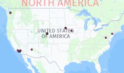
Just a reminder that we are tracking these solar speed radar sign locations

usa map

Where Are Solar Speed Radar Signs Located?
Solar-powered speed radar signs — sometimes called “speed radar signs” — are becoming more common on U.S. roadways. These devices don’t issue tickets; instead, they detect a vehicle’s speed and flash a warning when a driver is exceeding the limit. They act as a visual reminder to slow down, rather than as an enforcement tool. At PhotoEnforced, we’re actively tracking the locations of these radar signs across the country and maintaining a public map. As of May 2020, we’ve cataloged 53 known speed radar signs and continue to add new ones based on submissions from our users and field observations.

What Are Solar Speed Radar Signs?

Unlike conventional speed cameras that generate tickets, solar radar signs are passive warning systems. Their main features:

  • Solar-powered: They run off solar panels, so they’re self-sustaining and don’t require external wiring or grid power.

  • Non-ticketing: They detect when you exceed the posted speed limit and flash a warning, but they don’t issue citations or capture your license plate for enforcement.

  • Awareness tool: Their goal is to encourage safer driving behavior in sensitive or hazard-prone zones, such as near schools, parks, or residential streets.
    Because they’re low-cost, easy to deploy, and non-intrusive in terms of power infrastructure, they are increasingly popular in areas where cities want to improve safety without installing full-fledged automated enforcement systems.

Why Track Their Locations?

Knowing where these radar signs are placed is useful for several reasons:

  1. Road safety awareness: Drivers who are aware of radar sign locations may slow down in those areas. That in turn helps reduce speed-related crashes or near-misses, especially in zones with higher pedestrian traffic.

  2. Community transparency: Since these signs are not enforcement devices (they don’t issue tickets), mapping them helps differentiate them from speed cameras. This clarity helps citizens understand what’s warning versus what’s enforcing.

  3. Data and planning: Municipalities, planners, and researchers can use the location data to analyze patterns: which roads tend to get these signs, how effective they are, and where future deployments might make sense.

  4. Public engagement: Because some of the deployments come from community or grassroots efforts, having a shared map allows civic-minded drivers to report signs, verify them, or question whether more are needed in their area.

Where You’ll Find Them

From our database and reports, radar signs tend to cluster in certain kinds of zones:

  • School zones & around schools: Areas where children cross streets or walk frequently are high-priority locations for visual speed reminders.

  • Parks, playgrounds, and recreation areas: When there’s pedestrian activity or relaxed street design, these zones often see radar signs.

  • Residential neighborhoods: In streets with local traffic but speed issues, particularly those adjacent to schools or parks, radar signs are often used to calm traffic.

  • Transition zones or gateways: At places where speed limits change—such as when entering a lower-speed residential or school zone—the radar signs act as a reminder as drivers transition from faster roads.

  • Spots with crash history or safety concerns: Roads with a history of speeding crashes or near-misses may get radar signs as part of a “fix-it-first” safety approach.
    Because the devices are solar powered and relatively simple, they’re well-suited for roads where traditional enforcement systems would be expensive or impractical.

How to Add a Radar Sign to the Map

If you spot a solar radar sign and it’s not yet on the PhotoEnforced map, you can submit a location. Typically, you’ll need:

  • A photo of the sign (to confirm it’s indeed a radar sign and not an enforcement camera).

  • The address, intersection, or GPS coordinates.

  • Any additional notes (e.g. speed limit posted, direction of travel, nearby school or park).
    These crowd-sourced submissions help expand the map’s coverage and accuracy. Over time, as more people contribute, the database becomes more robust and useful for all.

Current Count & Map

As of May 2020, we’ve logged 53 solar radar signs. The map is publicly available and updated as new signs are verified and added. We encourage readers to contribute signs they’ve encountered. To explore current entries or add a sign yourself, you can use the PhotoEnforced “Add Speed Radar” submission tool and browse the interactive map. The map includes icons for each sign, letting users see where they are scattered across different states and regions. The map is not static — it’s updated regularly as contributors submit new locations or validate existing ones.

Why They Are Increasing in Use

Several advantages make solar radar signs appealing for communities and transportation departments:

  • Lower cost and easier deployment: Because there’s no wiring or grid connection, solar radar signs can be installed more cheaply and flexibly than full enforcement cameras.

  • Reduced controversy: Since they don’t issue tickets, these signs are less contentious from a policy or legal standpoint. They are more readily accepted by communities wary of automated enforcement.

  • Behavioral impact with less intrusion: Studies and anecdotal evidence suggest that visual feedback—“you’re driving too fast” flashing signs—can lead to voluntary speed reduction, especially in familiar areas.

  • Scalable & modular: You can place them in many locations (e.g. school zones, side streets) without committing to more complex camera systems.

  • Public relations & safety image: For local governments, installing radar signs is often seen as a safety-friendly move, signaling to constituents that authorities care about local road speed and pedestrian safety.

Limitations & Considerations

Despite their benefits, there are a few caveats:

  • Effect may wear off: Over time, drivers may habituate to the signs and stop reacting to the flashing when exceeding the speed limit.

  • No enforcement power: Because they don’t capture license plates or issue fines, their effect relies entirely on voluntary compliance.

  • Placement matters: If a sign is off to the side, hidden by foliage, or not well aligned with the roadway, drivers may not see it in time for the visual cue to be meaningful.

  • Not a substitute for enforcement in high-risk areas: In zones with chronic speeding or dangerous crash histories, stronger enforcement tools may still be needed in conjunction with radar signs.

  • Maintenance & calibration: Even though they are simpler than cameras, radar signs need upkeep — solar panels need cleaning, the equipment must be calibrated, and the electronics must be protected from tampering or vandalism.

What You Can Do as a Driver or Citizen

  • Learn where they’re located: Use the interactive map to see whether any radar signs are near your home, school, or commute path.

  • Help expand the map: If you see a new sign, submit it — a photo, location, and some details go a long way.

  • Drive more mindfully: The presence of a flashing radar sign is an indicator: you’re in a zone where speed is a concern, so slow down and be alert to pedestrians, intersections, or children.

  • Advocate locally: If your community lacks radar signs in high-risk corridors, you can suggest them to your transportation or public works departments as low-cost safety tools.

We call these locations "speed radar signs" in our database.  The new speed radar signs are typically solar-powered like this image below.  They don't issue tickets but flash when you are going over the speed limit to warn you to slow down.  


These new cameras are popping up all over the place and you can easily add them to our database here.  The locations are important to track in the database because they are typically dangerous locations around schools, parks, and schools.  

Submit a new solar speed radar sign here. 

New York City Quadrupling Red-Light Cameras by 2027: 2025 Update

In 2024, lawmakers authorized New York City to quadruple its red-light camera network from 150 intersections to as many as 600 by 2027. The goal is to curb reckless driving, reduce crashes, and increase compliance at dangerous intersections. Now, in 2025, the program is beginning its next phase. While the legislation has been passed, the rollout is gradual, and drivers across the city are watching closely to see where the cameras will appear next. This article provides a full update on the current status of the program, new vendor contracts, the timeline for installations, policy debates, and what drivers should expect over the next two years.

Why New York City Is Expanding Red-Light Cameras

Red-light running is one of the most common causes of traffic crashes in New York City. With an increase in pedestrian and cyclist injuries, city leaders argue that automated enforcement is a proven tool to discourage risky behavior at intersections. By quadrupling the number of cameras, the city hopes to reduce intersection crashes by deterring drivers from running lights, improve pedestrian safety in crowded crosswalks, supplement NYPD enforcement that has limited resources to monitor every signalized intersection, and collect reliable traffic data to guide future road safety strategies.

The 2024 Law and What It Means in 2025

In 2024, the New York State legislature approved a measure allowing New York City to expand its red-light camera program from 150 to 600 intersections. The authorization also extended the program until at least 2027. However, passing the law was only the first step. Implementation requires contracting with a vendor, analyzing crash data to select sites, and installing cameras citywide. As of mid-2025, the system still operates with the original 150 red-light cameras, but the Department of Transportation has confirmed that hundreds of new locations are in planning.

New Vendor: Verra Mobility Takes Over

A major development in 2025 was the city’s decision to award the new contract to Verra Mobility, a leading traffic enforcement technology provider. Verra Mobility is already a significant player in automated enforcement nationwide, and its systems manage red-light, speed, and school-zone cameras across the United States. This vendor transition ensures that New York City’s program will be managed under updated technology, with better back-end processing systems, improved reliability, and the ability to handle a much larger network. The contract is expected to cover the entire expansion phase through 2027.

How Many Cameras Are Coming and Where They May Be Placed

By the end of 2027, New York City will have up to 600 red-light camera intersections. For comparison, the current 150 locations represent only a fraction of the city’s signalized intersections, meaning enforcement is still relatively limited. Placement of new cameras will not be random. The Department of Transportation is prioritizing intersections with high crash rates, frequent pedestrian injuries, and data showing high levels of red-light running. While some critics argue cameras will be placed in areas with the most revenue potential, city officials maintain that safety data guides the process.

Will Existing Cameras Move?

Current red-light cameras are fixed in place and will not be relocated. New sites will be selected based on crash history and safety analysis. This provides stability to drivers who already know which intersections are photo-enforced while also expanding coverage to new areas where violations are common. Officials have stated that if relocation does occur in the future, it will only be after a careful data-driven review.

Relationship to Speed Cameras

The expansion of red-light cameras is occurring at the same time as an expansion of the city’s speed camera program. New York already operates more than 2,000 speed cameras in school zones, and the program was extended through 2030. Together, red-light and speed cameras form the backbone of the city’s automated traffic enforcement system, addressing both signal violations and excessive speeding.

Fines and Penalties

Red-light camera tickets in New York City carry a $50 fine. Unlike traditional traffic tickets issued by a police officer, they do not add points to a driver’s license. This makes them civil penalties rather than moving violations. Tickets are issued to the registered owner of the vehicle, not necessarily the driver. Violations include photographic and video evidence that can be reviewed online by the ticket recipient. While the fine amount has remained steady, many have speculated that fines could increase as the program grows. However, city officials have suggested that the flat $50 fine keeps the program fair and consistent.

Criticism of the Program

Despite its safety goals, New York City’s red-light camera program has drawn criticism. Opponents argue that the cameras are more about revenue generation than safety and that they disproportionately affect working-class drivers who cannot easily afford the fines. Others raise concerns about privacy, accuracy, and the fairness of mailing tickets to vehicle owners rather than identifying drivers. Another major criticism is the timing of yellow lights. Some motorists claim that short yellow lights trap drivers into violations, and there is pending legislation in Albany that could standardize yellow light timing at a minimum of four seconds across the state. If passed, this would impact how violations are enforced and contested.

Support for the Expansion

Supporters of the expansion argue that the evidence is clear: red-light cameras reduce violations and crashes at intersections where they are installed. Studies from multiple states show decreases in both red-light running and T-bone crashes after camera enforcement begins. In a dense urban environment like New York City, where pedestrian and cyclist safety is a top priority, the cameras are seen as a vital tool. Community boards and safety advocates have largely backed the program, pointing to the thousands of injuries that occur annually due to red-light running.

What Drivers Should Expect in 2025 and Beyond

Drivers should prepare for gradual camera activations starting in late 2025 and continuing through 2027. Each new site will be announced in advance, and warning periods may be implemented before fines begin. Notices of Liability will continue to be mailed to registered owners, with photos and video evidence available online. Because the city is dramatically scaling up enforcement, drivers can expect to encounter red-light cameras in more neighborhoods than ever before. Intersections that previously had no monitoring could soon carry cameras, meaning habits like rolling through late yellow lights or speeding through the red will become increasingly risky.

Long-Term Implications

The long-term vision is to make automated enforcement a permanent part of traffic safety in New York City. If the 600-camera expansion proves successful, the program could be extended again beyond 2027. With the rise of new technologies, it is also possible that cameras could expand to detect additional violations, such as blocking the box or failing to yield to pedestrians. Automated enforcement is increasingly becoming the standard in large cities worldwide, and New York City is moving to keep pace.

Conclusion

New York City’s red-light camera expansion is one of the largest in the nation. While the law authorizing up to 600 cameras has been passed, 2025 is a transitional year as the city finalizes contracts, analyzes crash data, and prepares to begin installation. By 2027, drivers should expect photo enforcement at hundreds of additional intersections. The expansion reflects a broader trend toward automated enforcement designed to improve safety in one of the busiest traffic environments in the world. Whether you view the cameras as a revenue tool or a life-saving measure, they are becoming a permanent part of New York City’s streetscape.

Cities Lower Speed Limits to Boost Fines: Safety or Revenue?

Cities Lowering Speed Limits to Increase Fines: Is It About Safety or Revenue? 

New York Speed Cameras: Expansion, Laws & Fines (2014–2030)

speed camera yellow
speed camera grey

More Than 2,000 Speed Cameras Are Now a Reality: What You Need to Know in 2025

Over a decade ago, the idea of deploying some 2,000 speed cameras in and around New York seemed ambitious. Today, that plan is not only realized — it has expanded and become central to New York City’s traffic safety strategy. What began as a 2014 proposal to deploy hundreds of new cameras across Long Island and the city now forms the backbone of Vision Zero and school zone enforcement efforts.

If you drive in New York today, here’s a clear, up-to-date guide to how these systems work, where they operate, and what’s new as of 2025.  NY Speed Cameras map.

A Decade-Long Journey: From Proposal to City-Wide Enforcement

The 2014 Proposal

In 2014, the New York State Senate passed a bill permitting more than 2,000 new speed cameras in New York City and surrounding counties. That bill authorized:

  • Up to 69 cameras in Suffolk County

  • 56 in Nassau County

  • An additional 120 cameras for New York City, atop the 20 already operational

These cameras were intended primarily for use before, during, and after school hours. Violators would be mailed $50 tickets for recorded speeding.

That marked the early push to expand automated speed enforcement beyond limited pilot zones into broader city and suburban coverage.

The Transition to 24/7 and Full Deployment

Over time, the program expanded in scope and authority:

  • In 2022, New York City began issuing speed camera violations 24/7, year-round, covering 750 school speed zones across all five boroughs.

  • As of 2025, NYC maintains approximately 2,200 active speed cameras covering these zones.

  • The cameras trigger fines for vehicles exceeding the posted speed by 10 mph or more (11+ mph over the limit).

The shift to 24/7 enforcement dramatically increased detection and fines — but more importantly, it solidified the role of speed cameras as a consistent deterrent, not just a daytime tool.

What’s New in 2025: Extensions, Expansions, and Enhancements

Program Reauthorization Through 2030

One of the biggest recent developments is legislative reauthorization:

  • In June 2025, the Governor signed legislation extending New York City’s school-zone speed camera program through July 1, 2030.

  • This law also strengthens enforcement rules, repeals outdated sections, and ensures continued deployment across the city.

Without this reauthorization, the program would have expired on July 1, 2025, causing the city’s 2,200+ cameras to go dark.

Work Zone & Highway Enforcement Expansion

In addition to school zones, New York has been piloting and expanding work-zone speed camera enforcement, particularly on state highways, bridges, and tunnels.

  • Proposed legislation aims to expand enforcement in work zones on the New York State Thruway and DOT-maintained highways and make the program permanent.

  • Officials are pushing to make these systems standard in MTA bridges and tunnels as part of the upcoming state budget.

  • The current Automated Work Zone Speed Enforcement systems operate where signage is posted, and cameras are activated after daily self-checks.

These expansions are especially aimed at protecting construction workers and managing speeds in high-risk highway settings.

Speed Limiter / “Super Speeder” Legislation

To address repeat offenders, lawmakers and city officials are pushing for intelligent speed assistance devices:

  • A proposed bill would require vehicles to install speed limiters if drivers rack up multiple violations (for example, 11 or more speed or camera tickets in 24 months).

  • The campaign is supported by evidence that a small group of drivers — sometimes called “super speeders” — are disproportionately involved in serious crashes.

  • However, the bill has been softened in negotiations, and red-light violations have been removed from some proposed thresholds.

Whether this legislation becomes law will influence how aggressive enforcement becomes in the coming years.

How the Cameras Work & What Happens if You’re Caught

Detection & Violation Process

  • Cameras operate 24/7, 365 days a year in school zones.

  • They photograph only vehicles going more than 10 mph above the limit (11+ mph).

  • The system filters out unclear captures, and DOT reviews to confirm that the vehicle is properly identified before issuing a Notice of Liability (NOL).

  • Once a violation is confirmed, the vehicle owner receives a Notice of Liability by mail in about 14 days.

  • The standard fine is $50 for an exceedance of 10+ mph.

If the violation is contested, you may dispute it online, by mail, or in person. Ignoring it can lead to late penalties, interest, or even vehicle booting or towing.

Results & Behavioral Change

  • Severe traffic injuries have dropped nearly 30% at locations with new cameras.

  • Some camera placements have produced dramatic changes — one Manhattan location saw a 75% reduction in speeding after installation.

  • Researchers have found that measurable behavioral shifts (reduced speeding) take about six months to fully materialize, and effects vary by neighborhood.

These patterns underline that sustained enforcement, not one-off deployments, yields long-term safety gains.

Challenges, Pushback & Loopholes

Tampering & Plate Evasion

To evade camera detection, some drivers have attempted tricks like:

  • Obscuring license plates with plastic covers, reflective spray, or bending them.

  • Covering cameras with objects such as fake flower bouquets.

  • Between 2020 and 2022, over 1.5 million tickets were never issued due to unreadable or obscured plates, representing tens of millions in lost fines.

New rules in 2025 make obscuring or altering plates illegal, with fines of $50, reinforcing that legible plates are essential for automated enforcement to work.

Political & Public Resistance

While many advocates hail the safety benefits, critics argue:

  • Speed cameras are a revenue trap rather than purely safety measures.

  • Some complain that frequent violations in residential areas amount to over-policing of driving behavior.

  • Legislative negotiations have diluted possible penalties, with some proposed “super speeder” thresholds scaled back.

Still, the fact that Albany renewed the program through 2030 suggests broad legislative support for continued automated enforcement.

Your Rights & Best Practices as a Motorist

If you drive in New York, here’s what you should keep in mind:

  1. Know the Speed Zones
    Cameras are limited to school speed zones, roughly within a ¼ mile of schools in each direction.

  2. Mind the “+10 Rule”
    Cameras issue citations for 11 mph or more above the limit. Driving 10 mph over is below the threshold.

  3. Dispute If Incorrect
    If you believe your Notice of Liability was in error, you have 30 days to respond, pay, or contest.

  4. Avoid Plate Tampering
    Don’t obscure or alter your license plate. That itself may draw penalties and undermines your defense.

  5. Track Recurring Violations
    If you incur multiple violations, you may become subject to increased scrutiny or future laws requiring speed-limiting technology.

Why This Matters: Safety, Accountability & Vision Zero

Speed is a leading factor in crash severity. Automated enforcement programs like New York’s are part of the broader Vision Zero initiative — aiming to eliminate traffic deaths altogether.

Legislation and deployment adjustments reflect a belief by policymakers that speed cameras are more than revenue tools — they are critical tools to compel safer driving behavior, especially in school zones and work zones where vulnerable pedestrians and workers are present.

The reauthorization through 2030 signals that the city intends to maintain consistency in enforcement for years to come.

Final Thoughts

What was once a speculative plan in 2014 has matured into a robust, city-wide network of speed cameras, now standard equipment in New York’s traffic safety arsenal. The 2,200+ cameras operating in 750 school zones reflect the program’s growth. Legislative reauthorizations, expansion into work zones, and future speed-limiter proposals show that the system continues evolving — both in breadth and in intensity.

For motorists, the implications are clear: staying within posted limits, keeping license plates visible, and understanding your rights if you receive a Notice of Liability are essential in a city where speed enforcement is no longer novel — it’s expected.  Which states allow speed cameras?

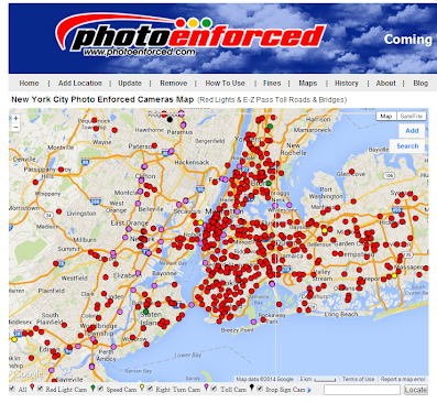
NYC red light cameras map

U.S. Cities Using Speed Cameras to Improve Road Safety

In the United States, many cities and counties have adopted speed cameras to reduce traffic violations, enhance public safety, and deter reckless driving. These cameras are strategically placed in areas prone to speeding, including school zones, highway work zones, and residential neighborhoods. In this article, we will explore the various U.S. cities and counties that have implemented speed cameras as part of their efforts to create safer driving environments.

Gwinnett County, Georgia School Zone Speed Camera Locations Map

Gwinnett County, Georgia, is taking proactive steps to enhance student safety through its School Zone Safety Program. This initiative, spearheaded by the Gwinnett County Police Department, employs automated speed enforcement cameras to deter speeding in school zones, aiming to protect students during their commutes.

What Is the School Zone Safety Program?

Launched in November 2021, the School Zone Safety Program is designed to reduce speeding near schools by utilizing automated speed detection cameras. These cameras operate in accordance with Georgia law (O.C.G.A. § 40-14-18), ensuring that motorists adhere to posted speed limits during school hours. The primary objective is to safeguard students, staff, and pedestrians in school zones.

How the Program Works

The speed enforcement cameras are active during specific times: one hour before the start of school, during school hours, and one hour after school ends. This schedule also applies during summer sessions when schools are in operation. 

When a vehicle exceeds the speed limit in a monitored school zone, the camera captures an image of the vehicle, and a citation is issued to the registered owner. This automated process ensures consistent enforcement and encourages drivers to maintain safe speeds.

Expansion and Impact

Since its inception, the program has expanded significantly. Initially implemented at three schools, it grew to include four additional schools in the 2022–2023 academic year: Archer High School, Corley Elementary School, Collins Hill High School, and Lanier Middle School. By 2023, nine more schools were equipped with speed detection cameras, reflecting the county's commitment to student safety.

The effectiveness of the program is evident, with a reported 95% reduction in speeding violations in the monitored school zones. This significant decrease underscores the program's success in promoting safer driving behaviors around schools.

Community Involvement and Compliance

The Gwinnett County Police Department emphasizes that the goal of the School Zone Safety Program is compliance, not revenue generation. By raising awareness and enforcing speed limits, the program seeks to create a safer environment for students.

Motorists are encouraged to stay informed about school zone locations and speed limits. For more information on the program and a list of monitored school zones, visit the official Gwinnett County School Zone Safety Program page.

By integrating technology and community engagement, Gwinnett County's School Zone Safety Program serves as a model for enhancing student safety and promoting responsible driving behaviors.

Gwinnett County's School Zone Safety Program has been instrumental in enhancing the safety of students by implementing automated speed enforcement cameras in various school zones.These cameras are strategically placed based on speed studies, accident data, and community feedback to deter speeding and protect pedestrians.

Below is a table listing the schools currently equipped with speed enforcement cameras, along with their respective speed limits and enforcement times:

SCHOOL ZONE CAMERA TIMES AM FLASHING LIGHT TIMES
SPEED LIMIT
PM FLASHING LIGHT TIMES
SPEED LIMIT
SPEED LIMIT
WHEN LIGHT IS OFF
Anderson-Livesey Elementary 7:15AM - 3:45PM 7:30AM – 8:30AM
35 MILES PER HOUR
 2:30PM – 3:30PM
35 MPH
 45 MPH
Archer High School
(New Hope)
6:15AM - 3:10PM 6:25AM - 7:25AM
35 MILES PER HOUR
 1:55PM – 2:55PM
35 MPH
 45 MPH
Archer High School
(Callie Still)
6:15AM - 3:10PM 6:25AM - 7:25AM
35 MILES PER HOUR
 1:55PM – 2:55PM
35 MPH
 40 MPH
Brookwood High School
(Dogwood Rd.)
6:20AM – 3:10PM 6:35AM – 7:35AM
25 MILES PER HOUR
1:55PM – 2:55PM
25 MPH
35 MPH
Brookwood High School
(Holly Brook Rd.)
6:20AM – 3:10PM 6:35AM – 7:35AM
25 MILES PER HOUR
1:55PM – 2:55PM
25 MPH
35 MPH
Corley Elementary School 7:50AM - 4:20PM 8:05AM – 8:35AM
35 MILES PER HOUR
 3:05PM – 3:35PM
35 MPH
 45 MPH
Duncan Creek Elementary School 7:50AM - 4:20PM 8:05AM – 9:05AM
35 MILES PER HOUR
 3:05PM – 4:05PM
35 MPH
 45 MPH
Graves Elementary School

7:15AM - 3:45PM

7:30AM – 8:30AM
25 MILES PER HOUR
 2:30PM – 3:30PM
25 MPH
 35 MPH
Jackson Elementary School

7:15AM - 3:45PM

7:30AM – 8:30AM
25 MILES PER HOUR
 2:30PM – 3:30PM
25 MPH
 40 MPH
Lanier Middle School
(Buford Dam)

7:15am - 5:00pm

7:30AM – 9:30AM
25 MILES PER HOUR
 2:30PM – 4:30PM
25 MPH
 35 MPH
Lanier Middle School
(Suwanee Dam)

7:15AM - 5:00PM

7:30AM – 9:30AM
25 MILES PER HOUR
 2:30PM – 4:30PM
25 MPH
 45 MPH
Meadowcreek High School 6:10AM – 3:10PM 6:15AM – 7:15AM
35 MILES PER HOUR
1:55PM – 2:55PM
35 MPH
45 MPH
North Gwinnett Middle School 7:55AM—5:00PM 8:35AM – 9:35AM
35 MILES PER HOUR
3:45PM – 4:45PM
35 MPH
45 MPH
Richards Middle School 7:55AM – 5:00PM 8:35AM – 9:35AM
35 MILES PER HOUR
3:30PM – 4:40PM
35 MPH
45 MPH
Starling Elementary School 7:15AM – 3:45PM 7:30AM – 8:30AM
35 MILES PER HOUR
2:30PM – 3:30PM
35 MPH
45 MPH
White Oak Elementary
(Buford Dam)
 7:15AM - 5:00PM 7:30AM – 9:30AM
25 MILES PER HOUR
 2:30PM – 4:30PM
25 MPH
 35 MPH
White Oak Elementary School
(Suwanee Dam)
7:15AM - 5:00PM 7:30AM – 9:30AM
25 MILES PER HOUR
 2:30PM – 4:30PM
25 MPH
 45 MPH

Note: Enforcement hours and speed limits are based on available data and may vary. Drivers should always observe posted signs and flashing lights indicating active school zones.

By staying informed and adhering to posted speed limits, drivers contribute to a safer environment for students and the broader community.

Gwinnett County, Georgia School Zone Speed Camera Locations Map

Columbus, Georgia School Zone Speed Camera Locations Map

Columbus, Georgia Red Light Camera & Speed Camera Map

If you drive through Columbus, Georgia, you’ve likely noticed flashing lights in school zones—and maybe even a camera or two. These aren’t just friendly reminders. They’re part of an automated speed enforcement system used by the city to protect children during school hours.  Here is a map of Georgia school speed cameras

In this guide, we’ll cover everything you need to know about Columbus, GA school zone speed camera locations, their operation times, speed limits, how they work, and tips to avoid getting ticketed.

🎯 What Are School Zone Speed Cameras?

School zone speed cameras are automated traffic enforcement systems used to detect and record vehicles exceeding posted speed limits during specific timeframes—usually when children are arriving or leaving school. Once a vehicle is recorded speeding, a citation is issued and mailed to the registered owner of the vehicle.

🔍 How Do They Work?

  1. Cameras are activated during school hours listed by the city.

  2. If a driver exceeds the posted speed limit during these times, the camera takes a photo of the license plate.

  3. A speeding ticket is mailed to the registered vehicle owner.

🕒 School Zone Speed Limits in Columbus, GA

Speed limits vary depending on the school zone and time of day. Typically:

  • During flashing light times: Speed limits drop to 20–30 mph.

  • When lights are not flashing: Standard speed limits of 30–45 mph apply.

Failure to obey these reduced limits can result in a fine, even if no police officer is present.

📍 Full List of Columbus GA School Zone Speed Camera Locations

Here’s a breakdown of every school in Columbus, GA with active speed cameras, including the street name, camera enforcement times, AM/PM flashing light periods, and speed limits.

School Zone Street Location Camera Hours AM Light & Speed PM Light & Speed Speed Limit (Lights Off)
Blackmon Road Middle Blackmon Rd 7:15 AM - 4:00 PM 7:15 AM - 8:45 AM (25 mph) 2:30 PM - 4:00 PM (25 mph) 45 mph
Blanchard Elementary Weems Rd 6:45 AM - 3:00 PM 6:45 AM - 8:15 AM (25 mph) 1:30 PM - 3:00 PM (25 mph) 35 mph
Clubview Elementary Edgewood Rd 6:45 AM - 4:00 PM 6:45 AM - 8:45 AM (25 mph) 1:30 PM - 4:00 PM (25 mph) 35 mph
Davis Elementary Shepherd Dr & Brown Ave 6:45 AM - 4:00 PM 6:45 AM - 8:45 AM (20 mph) 1:30 PM - 4:00 PM (20 mph) 30 mph
Dimon Elementary Steam Mill Rd 6:45 AM - 3:00 PM 6:45 AM - 8:15 AM (25 mph) 1:30 PM - 3:00 PM (25 mph) 35 mph
Double Churches Elem. Double Churches Rd 6:45 AM - 4:00 PM 6:45 AM - 8:45 AM (25 mph) 1:30 PM - 4:00 PM (25 mph) 45 mph
Double Churches Middle Whitesville Rd 6:45 AM - 4:00 PM 6:45 AM - 8:45 AM (25 mph) 1:30 PM - 4:00 PM (25 mph) 40 mph
Eagle Ridge / Shaw HS Schomburg Rd 6:45 AM - 4:30 PM 6:45 AM - 9:15 AM (30 mph) 1:30 PM - 4:30 PM (30 mph) 45 mph
Eddy Middle / South Columbus Elem. South Lumpkin Rd 6:45 AM - 4:00 PM 6:45 AM - 8:45 AM (25 mph) 1:30 PM - 4:00 PM (25 mph) 35 mph
Fort Middle School Woodruff Farm Rd 7:15 AM - 4:00 PM 7:15 AM - 8:45 AM (25 mph) 2:30 PM - 4:00 PM (25 mph) 40 mph
Georgetown Elementary Amber Dr 6:45 AM - 4:30 PM 6:45 AM - 9:15 AM (20 mph) 1:30 PM - 4:30 PM (20 mph) 30 mph
Hannan Elementary Warm Springs Rd 6:45 AM - 3:00 PM 6:45 AM - 8:15 AM (25 mph) 1:30 PM - 3:00 PM (25 mph) 35 mph
Lonnie Jackson / Rothschild Middle Hunt Ave 6:45 AM - 4:00 PM 6:45 AM - 8:45 AM (20 mph) 1:30 PM - 4:00 PM (20 mph) 30 mph
MLK Jr. Elementary Cussetta Rd 6:45 AM - 3:00 PM 6:45 AM - 8:15 AM (20 mph) 1:30 PM - 3:00 PM (20 mph) 30 mph
Midland Middle School Warm Springs Rd 6:45 AM - 4:00 PM 6:45 AM - 8:45 AM (25 mph) 1:30 PM - 4:00 PM (25 mph) 45 mph
Reese Road Leadership Academy Reese Rd 6:45 AM - 3:00 PM 6:45 AM - 8:15 AM (25 mph) 1:30 PM - 3:00 PM (25 mph) 35 mph
Rigdon Elementary / Rainey McCullers Rigdon Rd 6:45 AM - 4:30 PM 6:45 AM - 9:15 AM (20 mph) 1:30 PM - 4:30 PM (20 mph) 30 mph
River Road Elementary River Rd 6:45 AM - 3:00 PM 6:45 AM - 8:15 AM (30 mph) 1:30 PM - 3:00 PM (30 mph) 40 mph
Waddell Elementary Miller Rd 6:45 AM - 3:00 PM 6:45 AM - 8:15 AM (25 mph) 1:30 PM - 3:00 PM (25 mph) 35 mph
Wynnton Arts Academy Wynnton Rd 6:45 AM - 3:00 PM 6:45 AM - 8:15 AM (25 mph) 1:30 PM - 3:00 PM (25 mph) 30 mph

📌 Important Notes for Drivers

  • Speed cameras are active even if you don't see a police officer.

  • The fine for a speeding violation in a school zone in Columbus can range from $75 to over $100, depending on the speed and frequency of infractions.

  • Repeat offenders may face higher fines and additional penalties.

  • Flashing lights = speed camera is active. No flashing = normal speed limit applies, but use caution.

🚘 How to Fight or Pay a School Zone Speeding Ticket

If you’ve received a ticket from a school zone camera in Columbus:

  • Check your citation number and visit the official city payment portal.

  • If you want to contest the ticket, follow the instructions provided with the notice.

  • You typically have 30 days to respond.

🛑 Final Thoughts

School zone speed cameras are here to protect lives—especially those of our youngest pedestrians. Knowing where and when these cameras are active is essential for staying ticket-free and driving safely.

✅ Stay Safe Tips:

  • Always watch for school zone signs and flashing lights.

  • Set a reminder if your route passes a school during pickup/drop-off hours.

  • If unsure, default to a lower speed until you're out of the zone.

Columbus, Georgia School Zone Speed Camera Locations Map

Cape Coral Speed Camera Locations: Ensuring Safety in School Zones

Cape Coral, Florida, has implemented a critical safety initiative by installing speed cameras in school zones to protect children and reduce speeding violations. These cameras are strategically placed to monitor traffic in and around school zones during the hours when students are arriving and leaving school. The city’s proactive move aims to increase safety for students, teachers, and pedestrians and ensure compliance with speed limits. See our map of Cape Coral school speed camera locations

Kissimmee. Osceola County, Florida School Speed Cameras

What Are School Speed Cameras in Osceola County? 

Washington D.C. Adds Crosswalk Cameras for Safety

DC crosswalk cameras
Search the database for "Crosswalk" to find Crosswalk Camera Locations

Washington D.C. has become a pioneer in pedestrian safety by installing crosswalk cameras. This innovative move aims to improve traffic enforcement, reduce pedestrian accidents, and promote safer streets for both pedestrians and drivers. As one of the first cities to adopt this technology, Washington D.C. is setting an example for other cities looking to improve traffic safety through automated enforcement.

What Are Crosswalk Cameras?

Crosswalk cameras are automated traffic enforcement devices designed to monitor and enforce pedestrian traffic laws at crosswalks. These cameras are strategically placed at high-traffic intersections and are capable of capturing images of vehicles that fail to yield to pedestrians in crosswalks, violating traffic laws. Drivers who break the law receive fines based on the evidence captured by the cameras.

Is Washington, D.C. the First City to Install Crosswalk Cameras?

While Washington D.C. is not the first city to experiment with automated traffic enforcement cameras, it is one of the first to specifically implement crosswalk cameras. This system is a part of D.C.’s broader efforts to reduce pedestrian accidents and improve traffic safety. The District joins a growing list of U.S. cities that are leveraging technology to enforce traffic laws and protect pedestrians.

Why Did D.C. Install Crosswalk Cameras?

Rising Pedestrian Accidents

Pedestrian accidents in Washington D.C. have been a growing concern in recent years. The city has seen an uptick in the number of pedestrian fatalities and injuries, prompting city officials to take action. By installing crosswalk cameras, the city aims to enforce pedestrian right-of-way laws and deter drivers from engaging in risky behavior, such as failing to yield to pedestrians in crosswalks.

Vision Zero Initiative

The crosswalk camera program is part of D.C.'s Vision Zero initiative, a comprehensive plan to eliminate traffic-related deaths and injuries by 2030. The program focuses on engineering safer streets, educating the public, and enforcing traffic laws. Crosswalk cameras contribute to these efforts by ensuring that drivers comply with laws designed to protect pedestrians.

Public Awareness and Education

Beyond enforcement, the installation of crosswalk cameras serves to raise awareness about pedestrian safety. By publicly announcing the use of cameras and issuing fines, D.C. hopes to educate drivers on the importance of yielding to pedestrians and following traffic laws.

What Are the Benefits of Crosswalk Cameras?

Improved Pedestrian Safety

The primary benefit of crosswalk cameras is increased pedestrian safety. By holding drivers accountable for not yielding to pedestrians, the cameras help reduce the number of pedestrian accidents. Studies have shown that automated traffic enforcement can lead to a decrease in accidents at monitored locations.

Increased Driver Accountability

Crosswalk cameras provide an effective way to enforce traffic laws and hold drivers accountable for their actions. By issuing fines based on camera footage, the city ensures that violators are penalized, even if they are not caught by a police officer. This helps create a culture of accountability on the roads.

Revenue Generation for City Infrastructure

In addition to improving safety, crosswalk cameras generate revenue that can be reinvested into city infrastructure. The fines collected from traffic violations help fund projects that improve roadways, pedestrian infrastructure, and public safety.

Challenges and Considerations

Privacy Concerns

One of the key challenges associated with crosswalk cameras is privacy. Some residents have raised concerns about surveillance and the potential misuse of camera data. However, city officials argue that the cameras are focused solely on traffic enforcement and are not used for general surveillance.

Public Perception and Acceptance

While crosswalk cameras have been effective in improving safety, some drivers may view them as an infringement on their rights or as a means of generating revenue. Public perception of the program is crucial to its success, and ongoing education and outreach are essential to ensure that the public understands the program's goals and benefits.

Conclusion

Washington D.C.'s decision to install crosswalk cameras represents a significant step forward in the city’s efforts to enhance pedestrian safety. By using automated technology to enforce traffic laws, the city is not only improving safety for pedestrians but also setting an example for other cities considering similar initiatives. As the program continues to evolve, Washington D.C. will likely see reductions in pedestrian accidents and a shift toward safer, more responsible driving habits.

Popular Articles (All Time)