Showing posts with label maps. Show all posts

Newport to Launch Speed & Red Light Cameras at Major Intersection

The City of Newport, Rhode Island is rolling out its first automated traffic enforcement cameras at the intersection of Hillside Avenue and Admiral Kalbfus Road. Beginning Thursday, July 24, 2025, drivers should expect enforcement of both red light and speed camera violations.

📍 Map & Location Details

The enforcement zone is located at the intersection of Hillside Avenue and Admiral Kalbfus Road, a high-traffic area that connects several neighborhoods and commuter routes. Traffic data and crash reports prompted the selection of this intersection for camera enforcement.  Here is a map of red light cameras and speed cameras in Rhode Island

📆 Timeline & Grace Period

There will be a 30-day warning period starting July 24. During this time, drivers who commit violations will receive warnings rather than citations. Full enforcement, including fines, will begin after August 23, 2025.

💵 Violation Fines

  • Speeding (10+ mph over limit): $50 fine
  • Running a red light: $100 fine

🚨 Enforcement Hours

Cameras will operate 24/7, capturing violations regardless of time or weather conditions. Each citation includes photo and video evidence mailed to the registered vehicle owner.

🎯 Goal: Safer Streets, Not Revenue

Newport Police Chief Ryan Duffy emphasized that the cameras are designed to supplement—not replace—officer presence and are part of a broader safety initiative to reduce accidents and protect pedestrians.

📊 Camera Enforcement in Context

Newport joins other U.S. cities in adopting camera enforcement. Similar programs in Washington, D.C. and Chicago have reported significant reductions in dangerous angle crashes but raised questions about fairness and privacy.

✅ What Drivers Should Do

  • Obey posted speed limits—especially near intersections.
  • Do not run yellow or red lights to avoid a ticket.
  • Watch for warning signs approaching the camera zone.
  • Check your mail if you believe you were photographed.

📍 Map Coming Soon

Stay tuned to PhotoEnforced.com for the latest updates and maps of traffic camera locations in Newport and throughout Rhode Island.

Bradenton, Florida School Zone Speed Cameras Map

BRADENTON, Fla. – As the 2025-26 school year begins, drivers in Bradenton are being reminded by the Bradenton Police Department that school zone speed cameras are active and fully operational, despite Manatee County suspending enforcement outside city limits. 

Map of Minneapolis Speed Cameras Pilot Program

The City of Minneapolis has announced the installation of five automated speed enforcement cameras as part of a new Vision Zero initiative to curb dangerous driving and improve pedestrian safety. The pilot program will begin in September 2025 with a 30-day warning period before issuing real citations in October.

📍 New Minneapolis Speed Camera Locations

Map of Baltimore, Maryland School Speed Camera Locations

Baltimore City and Baltimore County have installed numerous school zone speed cameras to improve student safety and promote responsible driving. These automated systems are placed strategically near schools to deter speeding and reduce accidents.  Here is a map of Baltimore Speed Camera and Red Light Camera Locations

📍 Baltimore City School Zone Speed Camera Locations

Baltimore City's Automated Traffic Violation Enforcement System (ATVES) operates both fixed and portable speed cameras. These cameras are active Monday through Friday, from 6:00 AM to 8:00 PM, all year round. Drivers going more than 12 mph over the speed limit in these zones can expect a $40 fine (no points assessed to their license).

Recent Additions:

  • Belair Road (3700–4800 blocks): Near The Green School of Baltimore and Belair-Edison School

  • Hamilton Avenue (4500–4800 blocks): Serves Hazelwood Elementary/Middle School

  • Echodale Avenue (3600–3900 blocks): Close to Arts & Ideas Sudbury School and Gardenville Elementary

  • Hillen Road (5000–5300 blocks): Near Northwood Elementary School

  • Belair Road (6000–6200 blocks): Serves Glenmount Elementary/Middle School and City Neighbors Charter School

  • W. Franklin Street (2100 block): Close to Mary Ann Winterling Elementary School

  • Mt. Royal Terrace (2200 block): Covers nearby educational institutions

Other Notable Locations Include:

  • Gwynns Falls Parkway (2300 block)

  • Edmondson Avenue (4400 block)

  • Walther Avenue (5900 block)

  • Loch Raven Boulevard (3400 block)

  • Reisterstown Road (2800 and 3900 blocks)

  • Belair Road (2400 and 6000 blocks)

  • Liberty Heights Avenue (3100 and 3800 blocks)

  • North Charles Street (5000 block)

  • Northern Parkway (600 block)

  • E. Cold Spring Lane (1500 block)

  • Park Heights Avenue (multiple segments)

  • Wabash Avenue (5300–5500 blocks)

  • E. Pratt Street (1000–1100 blocks)

  • Roland Avenue (5000 block)

  • and many others across the city

Note: For a complete and current list, visit the Baltimore City Department of Transportation.

📍 Baltimore County School Zone Speed Camera Locations

Baltimore County also operates speed cameras in various school zones, with enforcement hours Monday through Friday, 6:00 AM to 8:00 PM. A $40 citation is issued to drivers going 12 mph or more over the speed limit. These measures are in place year-round, including during school breaks.

Newly Activated Locations (2024):

  • Cromwell Valley Elementary School: 900 block of Providence Road

  • Lyons Mill Elementary School: 4300 block of Owings Mills Boulevard

  • Franklin High School: 100 block of Franklin Boulevard

  • Pretty Boy Elementary School: 19800 block of Middletown Road

  • Redeemer Classical Christian School: 6400 block of Mount Vista Road

Additional New Locations (2025):

  • Belle Grove Elementary School — Brooklyn Park

  • Linthicum Elementary School — Linthicum Heights

  • School of the Incarnation — Gambrills

  • Van Bokkelen Elementary School — Severn

  • Benfield Elementary School — Severna Park

  • Marley Middle School — Glen Burnie

For the most updated list of Baltimore County speed camera locations, check the Baltimore County Government’s website.

⚖️ Speed Camera Enforcement Details

  • Active Days: Monday through Friday

  • Active Hours: 6:00 AM to 8:00 PM

  • Violation Threshold: 12+ mph over the limit

  • Fine Amount: $40

  • Points on License: None

  • Warning Period for New Cameras: 30 days (typically)

🛡️ The Safety Impact

The school zone camera program is designed to:

  • Increase pedestrian safety for students, families, and staff

  • Curb dangerous speeding habits in high-traffic zones

  • Reduce collisions and injuries in school areas

New cameras near Belair Road and other zones were installed in response to pedestrian fatalities, reinforcing the program’s role in saving lives.

🔗 Stay Informed

Map of Baltimore, Maryland School Speed Camera Locations

Coconut Creek, Florida School Zone Speed Camera Locations Map


Coconut Creek, FL, has implemented automated school speed zone cameras to improve safety for children and reduce speeding violations near schools. If you're a resident or commuter in the area, understanding where these cameras are and how they operate can help you avoid fines and keep the community safer.  Here is a map of speed cameras in Florida

What Are School Speed Cameras?

Tempe, Arizona Speed Camera Locations: Where Are They?

Chicago Speed Camera Locations: Where Are They?

If you're driving in Chicago, you're bound to come across speed cameras. As part of the city’s automated traffic enforcement program, these cameras are designed to reduce speeding near parks and schools — and they've become a growing concern for both residents and commuters. Whether you're trying to avoid a ticket or just want to know where enforcement is most active, understanding the locations of Chicago speed cameras can help you stay informed and safe on the road.  

Why Chicago Uses Speed Cameras

Chicago first implemented speed cameras in 2013 under the rationale of increasing pedestrian safety. Cameras are typically placed near parks and schools, but enforcement has expanded significantly across the city. According to the Chicago Department of Transportation (CDOT), the goal is to encourage drivers to slow down — especially in areas with high foot traffic.

These cameras operate 24/7, and a single violation can result in fines ranging from $35 to $100, depending on the speed. The fine system is structured to penalize those driving 6 mph or more over the posted limit.

Interactive Map & Full Camera List

To view an interactive map of all current speed and red-light camera locations in Chicago, visit Chicago Speed Cameras Map, where our database is continuously updated.

Complete List of Chicago Speed Camera Locations

We’ve compiled a comprehensive and current list of over 250 speed camera locations throughout the city. These cameras monitor both directions unless otherwise noted. Here are just a few key areas:

  • Fullerton Ave – Multiple cameras at 5446, 5509, 6247, and 6250 W Fullerton monitoring EB/WB traffic

  • Western Ave – Coverage stretches from 4433 N to 7739 S Western

  • Pulaski Rd – Active monitoring at 5030, 4929, 5433, and 7826 S Pulaski

  • Ashland Ave – Cameras along both the North and South sides, including 3111 N and 8345 S

  • Irving Park Rd – Includes monitoring near 2705, 2712, 2501, and 5454 W Irving Park

To see the full, detailed list with exact addresses and directions (e.g., Northbound, Southbound, Eastbound, Westbound), check out our Chicago Speed Camera List.

Common Questions About Speed Cameras in Chicago

Are speed camera tickets enforceable?

Yes. They are considered civil violations and are enforceable by law. Unpaid tickets may lead to license suspensions or additional fines.

Can you fight a Chicago speed camera ticket?

Yes, but it requires submitting evidence or demonstrating an error (e.g., incorrect plate reading, vehicle stolen, etc.). Instructions are usually printed on the ticket.

How can I avoid speed camera tickets?

Use real-time traffic apps, stay updated with our camera map, and of course — follow the speed limits, especially in school zones and park areas.

Final Thoughts

Whether you're a city driver or an out-of-town visitor, being aware of Chicago’s speed camera locations can save you from unnecessary fines and encourage safer driving. As more cameras are added or relocated, staying informed is key.

Bookmark this page or check PhotoEnforced.com regularly for updates — and drive smart, Chicago.

Chicago Speed Camera Locations Where Are They

SF Speed Camera Locations: Where They Are They?

San Francisco has recently rolled out new speed cameras in an effort to improve road safety and reduce speeding across the city. If you're driving in the city, it's essential to know where these cameras are located and how much speeding tickets could cost you. Below is a comprehensive guide to San Francisco speed camera locations, their operational status, and the fines associated with violations.  Here is another map of San Francisco speed cameras.  

Why Speed Cameras Matter

U.S. Cities Using Speed Cameras to Improve Road Safety

In the United States, many cities and counties have adopted speed cameras to reduce traffic violations, enhance public safety, and deter reckless driving. These cameras are strategically placed in areas prone to speeding, including school zones, highway work zones, and residential neighborhoods. In this article, we will explore the various U.S. cities and counties that have implemented speed cameras as part of their efforts to create safer driving environments.

Gwinnett County, Georgia School Zone Speed Camera Locations Map

Gwinnett County, Georgia, is taking proactive steps to enhance student safety through its School Zone Safety Program. This initiative, spearheaded by the Gwinnett County Police Department, employs automated speed enforcement cameras to deter speeding in school zones, aiming to protect students during their commutes.

What Is the School Zone Safety Program?

Launched in November 2021, the School Zone Safety Program is designed to reduce speeding near schools by utilizing automated speed detection cameras. These cameras operate in accordance with Georgia law (O.C.G.A. § 40-14-18), ensuring that motorists adhere to posted speed limits during school hours. The primary objective is to safeguard students, staff, and pedestrians in school zones.

How the Program Works

The speed enforcement cameras are active during specific times: one hour before the start of school, during school hours, and one hour after school ends. This schedule also applies during summer sessions when schools are in operation. 

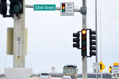
When a vehicle exceeds the speed limit in a monitored school zone, the camera captures an image of the vehicle, and a citation is issued to the registered owner. This automated process ensures consistent enforcement and encourages drivers to maintain safe speeds.

Expansion and Impact

Since its inception, the program has expanded significantly. Initially implemented at three schools, it grew to include four additional schools in the 2022–2023 academic year: Archer High School, Corley Elementary School, Collins Hill High School, and Lanier Middle School. By 2023, nine more schools were equipped with speed detection cameras, reflecting the county's commitment to student safety.

The effectiveness of the program is evident, with a reported 95% reduction in speeding violations in the monitored school zones. This significant decrease underscores the program's success in promoting safer driving behaviors around schools.

Community Involvement and Compliance

The Gwinnett County Police Department emphasizes that the goal of the School Zone Safety Program is compliance, not revenue generation. By raising awareness and enforcing speed limits, the program seeks to create a safer environment for students.

Motorists are encouraged to stay informed about school zone locations and speed limits. For more information on the program and a list of monitored school zones, visit the official Gwinnett County School Zone Safety Program page.

By integrating technology and community engagement, Gwinnett County's School Zone Safety Program serves as a model for enhancing student safety and promoting responsible driving behaviors.

Gwinnett County's School Zone Safety Program has been instrumental in enhancing the safety of students by implementing automated speed enforcement cameras in various school zones.These cameras are strategically placed based on speed studies, accident data, and community feedback to deter speeding and protect pedestrians.

Below is a table listing the schools currently equipped with speed enforcement cameras, along with their respective speed limits and enforcement times:

SCHOOL ZONE CAMERA TIMES AM FLASHING LIGHT TIMES
SPEED LIMIT
PM FLASHING LIGHT TIMES
SPEED LIMIT
SPEED LIMIT
WHEN LIGHT IS OFF
Anderson-Livesey Elementary 7:15AM - 3:45PM 7:30AM – 8:30AM
35 MILES PER HOUR
 2:30PM – 3:30PM
35 MPH
 45 MPH
Archer High School
(New Hope)
6:15AM - 3:10PM 6:25AM - 7:25AM
35 MILES PER HOUR
 1:55PM – 2:55PM
35 MPH
 45 MPH
Archer High School
(Callie Still)
6:15AM - 3:10PM 6:25AM - 7:25AM
35 MILES PER HOUR
 1:55PM – 2:55PM
35 MPH
 40 MPH
Brookwood High School
(Dogwood Rd.)
6:20AM – 3:10PM 6:35AM – 7:35AM
25 MILES PER HOUR
1:55PM – 2:55PM
25 MPH
35 MPH
Brookwood High School
(Holly Brook Rd.)
6:20AM – 3:10PM 6:35AM – 7:35AM
25 MILES PER HOUR
1:55PM – 2:55PM
25 MPH
35 MPH
Corley Elementary School 7:50AM - 4:20PM 8:05AM – 8:35AM
35 MILES PER HOUR
 3:05PM – 3:35PM
35 MPH
 45 MPH
Duncan Creek Elementary School 7:50AM - 4:20PM 8:05AM – 9:05AM
35 MILES PER HOUR
 3:05PM – 4:05PM
35 MPH
 45 MPH
Graves Elementary School

7:15AM - 3:45PM

7:30AM – 8:30AM
25 MILES PER HOUR
 2:30PM – 3:30PM
25 MPH
 35 MPH
Jackson Elementary School

7:15AM - 3:45PM

7:30AM – 8:30AM
25 MILES PER HOUR
 2:30PM – 3:30PM
25 MPH
 40 MPH
Lanier Middle School
(Buford Dam)

7:15am - 5:00pm

7:30AM – 9:30AM
25 MILES PER HOUR
 2:30PM – 4:30PM
25 MPH
 35 MPH
Lanier Middle School
(Suwanee Dam)

7:15AM - 5:00PM

7:30AM – 9:30AM
25 MILES PER HOUR
 2:30PM – 4:30PM
25 MPH
 45 MPH
Meadowcreek High School 6:10AM – 3:10PM 6:15AM – 7:15AM
35 MILES PER HOUR
1:55PM – 2:55PM
35 MPH
45 MPH
North Gwinnett Middle School 7:55AM—5:00PM 8:35AM – 9:35AM
35 MILES PER HOUR
3:45PM – 4:45PM
35 MPH
45 MPH
Richards Middle School 7:55AM – 5:00PM 8:35AM – 9:35AM
35 MILES PER HOUR
3:30PM – 4:40PM
35 MPH
45 MPH
Starling Elementary School 7:15AM – 3:45PM 7:30AM – 8:30AM
35 MILES PER HOUR
2:30PM – 3:30PM
35 MPH
45 MPH
White Oak Elementary
(Buford Dam)
 7:15AM - 5:00PM 7:30AM – 9:30AM
25 MILES PER HOUR
 2:30PM – 4:30PM
25 MPH
 35 MPH
White Oak Elementary School
(Suwanee Dam)
7:15AM - 5:00PM 7:30AM – 9:30AM
25 MILES PER HOUR
 2:30PM – 4:30PM
25 MPH
 45 MPH

Note: Enforcement hours and speed limits are based on available data and may vary. Drivers should always observe posted signs and flashing lights indicating active school zones.

By staying informed and adhering to posted speed limits, drivers contribute to a safer environment for students and the broader community.

Gwinnett County, Georgia School Zone Speed Camera Locations Map

Columbus, Georgia School Zone Speed Camera Locations Map

Columbus, Georgia Red Light Camera & Speed Camera Map

If you drive through Columbus, Georgia, you’ve likely noticed flashing lights in school zones—and maybe even a camera or two. These aren’t just friendly reminders. They’re part of an automated speed enforcement system used by the city to protect children during school hours.  Here is a map of Georgia school speed cameras

In this guide, we’ll cover everything you need to know about Columbus, GA school zone speed camera locations, their operation times, speed limits, how they work, and tips to avoid getting ticketed.

🎯 What Are School Zone Speed Cameras?

School zone speed cameras are automated traffic enforcement systems used to detect and record vehicles exceeding posted speed limits during specific timeframes—usually when children are arriving or leaving school. Once a vehicle is recorded speeding, a citation is issued and mailed to the registered owner of the vehicle.

🔍 How Do They Work?

  1. Cameras are activated during school hours listed by the city.

  2. If a driver exceeds the posted speed limit during these times, the camera takes a photo of the license plate.

  3. A speeding ticket is mailed to the registered vehicle owner.

🕒 School Zone Speed Limits in Columbus, GA

Speed limits vary depending on the school zone and time of day. Typically:

  • During flashing light times: Speed limits drop to 20–30 mph.

  • When lights are not flashing: Standard speed limits of 30–45 mph apply.

Failure to obey these reduced limits can result in a fine, even if no police officer is present.

📍 Full List of Columbus GA School Zone Speed Camera Locations

Here’s a breakdown of every school in Columbus, GA with active speed cameras, including the street name, camera enforcement times, AM/PM flashing light periods, and speed limits.

School Zone Street Location Camera Hours AM Light & Speed PM Light & Speed Speed Limit (Lights Off)
Blackmon Road Middle Blackmon Rd 7:15 AM - 4:00 PM 7:15 AM - 8:45 AM (25 mph) 2:30 PM - 4:00 PM (25 mph) 45 mph
Blanchard Elementary Weems Rd 6:45 AM - 3:00 PM 6:45 AM - 8:15 AM (25 mph) 1:30 PM - 3:00 PM (25 mph) 35 mph
Clubview Elementary Edgewood Rd 6:45 AM - 4:00 PM 6:45 AM - 8:45 AM (25 mph) 1:30 PM - 4:00 PM (25 mph) 35 mph
Davis Elementary Shepherd Dr & Brown Ave 6:45 AM - 4:00 PM 6:45 AM - 8:45 AM (20 mph) 1:30 PM - 4:00 PM (20 mph) 30 mph
Dimon Elementary Steam Mill Rd 6:45 AM - 3:00 PM 6:45 AM - 8:15 AM (25 mph) 1:30 PM - 3:00 PM (25 mph) 35 mph
Double Churches Elem. Double Churches Rd 6:45 AM - 4:00 PM 6:45 AM - 8:45 AM (25 mph) 1:30 PM - 4:00 PM (25 mph) 45 mph
Double Churches Middle Whitesville Rd 6:45 AM - 4:00 PM 6:45 AM - 8:45 AM (25 mph) 1:30 PM - 4:00 PM (25 mph) 40 mph
Eagle Ridge / Shaw HS Schomburg Rd 6:45 AM - 4:30 PM 6:45 AM - 9:15 AM (30 mph) 1:30 PM - 4:30 PM (30 mph) 45 mph
Eddy Middle / South Columbus Elem. South Lumpkin Rd 6:45 AM - 4:00 PM 6:45 AM - 8:45 AM (25 mph) 1:30 PM - 4:00 PM (25 mph) 35 mph
Fort Middle School Woodruff Farm Rd 7:15 AM - 4:00 PM 7:15 AM - 8:45 AM (25 mph) 2:30 PM - 4:00 PM (25 mph) 40 mph
Georgetown Elementary Amber Dr 6:45 AM - 4:30 PM 6:45 AM - 9:15 AM (20 mph) 1:30 PM - 4:30 PM (20 mph) 30 mph
Hannan Elementary Warm Springs Rd 6:45 AM - 3:00 PM 6:45 AM - 8:15 AM (25 mph) 1:30 PM - 3:00 PM (25 mph) 35 mph
Lonnie Jackson / Rothschild Middle Hunt Ave 6:45 AM - 4:00 PM 6:45 AM - 8:45 AM (20 mph) 1:30 PM - 4:00 PM (20 mph) 30 mph
MLK Jr. Elementary Cussetta Rd 6:45 AM - 3:00 PM 6:45 AM - 8:15 AM (20 mph) 1:30 PM - 3:00 PM (20 mph) 30 mph
Midland Middle School Warm Springs Rd 6:45 AM - 4:00 PM 6:45 AM - 8:45 AM (25 mph) 1:30 PM - 4:00 PM (25 mph) 45 mph
Reese Road Leadership Academy Reese Rd 6:45 AM - 3:00 PM 6:45 AM - 8:15 AM (25 mph) 1:30 PM - 3:00 PM (25 mph) 35 mph
Rigdon Elementary / Rainey McCullers Rigdon Rd 6:45 AM - 4:30 PM 6:45 AM - 9:15 AM (20 mph) 1:30 PM - 4:30 PM (20 mph) 30 mph
River Road Elementary River Rd 6:45 AM - 3:00 PM 6:45 AM - 8:15 AM (30 mph) 1:30 PM - 3:00 PM (30 mph) 40 mph
Waddell Elementary Miller Rd 6:45 AM - 3:00 PM 6:45 AM - 8:15 AM (25 mph) 1:30 PM - 3:00 PM (25 mph) 35 mph
Wynnton Arts Academy Wynnton Rd 6:45 AM - 3:00 PM 6:45 AM - 8:15 AM (25 mph) 1:30 PM - 3:00 PM (25 mph) 30 mph

📌 Important Notes for Drivers

  • Speed cameras are active even if you don't see a police officer.

  • The fine for a speeding violation in a school zone in Columbus can range from $75 to over $100, depending on the speed and frequency of infractions.

  • Repeat offenders may face higher fines and additional penalties.

  • Flashing lights = speed camera is active. No flashing = normal speed limit applies, but use caution.

🚘 How to Fight or Pay a School Zone Speeding Ticket

If you’ve received a ticket from a school zone camera in Columbus:

  • Check your citation number and visit the official city payment portal.

  • If you want to contest the ticket, follow the instructions provided with the notice.

  • You typically have 30 days to respond.

🛑 Final Thoughts

School zone speed cameras are here to protect lives—especially those of our youngest pedestrians. Knowing where and when these cameras are active is essential for staying ticket-free and driving safely.

✅ Stay Safe Tips:

  • Always watch for school zone signs and flashing lights.

  • Set a reminder if your route passes a school during pickup/drop-off hours.

  • If unsure, default to a lower speed until you're out of the zone.

Columbus, Georgia School Zone Speed Camera Locations Map

Jefferson, Georgia School Zone Speed Camera Locations Map

Jefferson, GA – The Jefferson Police Department is launching a new School Zone Safety and Automated Traffic Enforcement Program to enhance the safety of students and reduce speeding in designated school zones. The initiative targets two critical areas: Jefferson Elementary-Academy on Old Pendergrass Road and Jefferson High School on US-129BUS/Washington Street.  Here is a map of Georgia school speed cameras

Program Purpose: Reducing Speeding in School Zones

This safety program aims to reduce excessive speeding and promote safe driving behaviors near schools. Speed studies conducted over five school days showed alarming results:

  • Jefferson Elementary-Academy School Zone:

    • 15,458 vehicles monitored

    • 2,429 drivers were speeding at 11 MPH or more over the limit

  • Jefferson High School Zone:

    • 29,260 vehicles monitored

    • 3,063 drivers speeding at 11 MPH or more

If these trends continued, over 22,000 monthly speeding violations could occur in these two school zones alone. Speeding is a leading contributor to traffic fatalities — in 2018 alone, 1,514 people lost their lives on Georgia roads, many due to preventable unsafe driving.

Enforcement Timeline and Citation Details

The program will begin with a warning period starting Wednesday, December 16, 2020, and will continue through February 1, 2021. During this period:

  • Vehicles traveling 11 MPH or more over the posted speed limit will receive warning citations by mail

  • No fines will be issued during this phase

  • Warnings are intended to educate drivers on the importance of reducing speed in school zones

Starting February 1, 2021, monetary citations will be issued:

  • First offense: $75 fine + $25 processing fee

  • Subsequent offenses: $125 fine + $25 processing fee

  • Unpaid fines may result in a hold on vehicle registration or title transfer until the fine is paid

  • Citations are civil violations and will not affect your driver’s license or insurance

Those who wish to contest a citation may do so in court before a judge.

Program Components: Speed, Education, and Community Awareness

The School Zone Safety Program consists of four key components:

  1. Speed Studies

  2. Public Information

  3. Education

  4. Enforcement (PI&E)

Parents and community members will receive educational materials via brochures, utility bill inserts, social media, and public service announcements (PSAs). Ongoing speed studies will occur at least four times during the first year to track program effectiveness.

School Zone Speed Camera Operation Schedule

Speed cameras will only operate on school days and during times when students and staff are present. Cameras will not operate on nights, weekends, holidays, or other non-school days.

Old Pendergrass Road (Jefferson Elementary-Academy School Zone):

  • School Zone Speed Limit: 25 MPH (flashing lights on)

    • Enforced from 7:00 AM – 8:30 AM and 2:15 PM – 4:00 PM

  • Standard Road Speed: 35 MPH

    • Enforced at all other school day times

Washington Street (US-129BUS – Jefferson High School Zone):

  • School Zone Speed Limit: 35 MPH (flashing lights on)

    • Enforced from 7:35 AM – 8:35 AM and 3:10 PM – 4:10 PM

  • Standard Road Speed: 45 MPH

    • Enforced at all other school day times

By focusing on child safety, speed reduction, and community education, the Jefferson Police Department hopes to create a safer environment around schools and prevent tragedies before they occur.

For more information, follow the Jefferson Police Department on social media or contact the department directly.

Jefferson, Georgia School Zone Speed Camera Locations Map

Macon-Bibb County School Zone Speed Camera Locations Map


In an effort to enhance school zone safety, Macon-Bibb County has installed speed enforcement cameras at multiple schools throughout the area. These cameras are aimed at deterring speeding and protecting students during their daily commute. See this map of Georgia school speed camera locations

Find Red Light Cameras Near You with an Interactive Red Light Camera Map

Interactive Red Light Camera Map

Driving through intersections can be stressful, especially when you're unsure about the presence of red light cameras. Whether you're looking to avoid fines or simply want to drive more cautiously, a red light camera map can be a valuable tool for navigating city streets safely.

What Are Red Light Cameras?

Red light cameras are automated traffic enforcement devices installed at intersections to capture images of vehicles that run red lights. These cameras help improve road safety by deterring reckless driving and reducing accidents.

How to Find Red Light Cameras Near Me

If you're searching for red light cameras near me, there are several ways to locate them:

  1. Use a Red Light Camera Map – Online tools and apps provide interactive maps showing the locations of red light cameras in real-time. Check out PhotoEnforced.com for an updated list of camera locations.

  2. Check Local Government Websites – Many cities and states publish lists of red light camera locations.

  3. Navigation Apps – Some GPS and mapping applications include red light camera alerts.

  4. Community Forums and Reports – Drivers often share updated information about red light cameras in online communities.

Why Use a Red Light Camera Map?

Using a red light camera map can help you:

  • Avoid Traffic Violations – Stay informed about intersections with cameras and avoid unnecessary tickets.
  • Drive More Cautiously – Knowing the locations of red light cameras can encourage safer driving habits.
  • Plan Your Routes Better – Find the best paths that help you avoid congested or heavily monitored intersections.

Stay Informed and Drive Safely

Whether you're commuting daily or just driving through a new city, staying aware of red light cameras near me can prevent fines and contribute to safer roads. Utilize a red light camera map to keep track of traffic enforcement locations and drive with confidence.

For the most up-to-date information, explore online red light camera databases and apps that provide live updates on traffic enforcement in your area, such as PhotoEnforced.com.

City of Kent, Washington Red Light Camera & Speed Camera Map

Kent, Washington Red Light Camera & Speed Camera Map

According to a recent report by the Kent Reporter, collisions at intersections equipped with red-light cameras in Kent have witnessed a significant surge, jumping by 144%. 

Red-Light Cameras on Route 83 in Oakbrook Terrace to Be Removed

Oakbrook Terrace, Illinois intersection with red light camera sign

In a recent ruling, a judge has decided that there will no longer be red-light cameras installed along Route 83 in Oakbrook Terrace. This decision comes as a significant development for the area's residents and motorists. Here is a map of Chicago's red light camera locations

New Alexandria, Virginia Speed Cameras Will Begin Fines June 15

Alexandria, Virginia Speed Cameras Map

Warnings have been issued on Tuesday for the addition of three new speed camera locations within Alexandria school zones.

What is the Best Mobile App or Website To View CDOT Cameras Map?

What Is the best website or mobile app to view CDOT cameras Map? 

CDOT Cameras Map - on a browser or web app

History of Maps and its Influence on Modern Life

old World map

From the earliest cave paintings to modern digital maps, the evolution of cartography has been a constant journey of discovery and innovation. And, with the advent of companies like Google, Google maps jobs have become a popular career path for many. But beyond their practical uses, maps have also had a profound impact on how we think, communicate, and even govern.

They have been used to establish borders, claim territories, and even wage wars. They have also been used in exploring new frontiers, connecting trade routes, and fostering scientific understanding. This article will take you on a journey through the rich history of maps and their influence on modern life.

From the earliest known maps of the ancient world to the latest cutting-edge technology, we'll explore how maps have shaped our understanding of the world and continue to shape our lives today. Whether you're a history buff, a tech enthusiast looking for Google map jobs on sites like Jooble, or simply curious about the world around you, this article is for you. Come along and discover the fascinating story of maps!

What is the History of Map?

The history of maps can be traced back to ancient civilizations such as the Egyptians, Greeks, and Romans. They created maps primarily for practical purposes such as navigation and land management. These early maps were usually simple drawings or diagrams representing landforms and landmarks.

They were mostly created on papyrus or parchment and were used for navigation on land and sea. Maps began to take on a more symbolic and religious significance during the Middle Ages. Here, they were often used in depicting the known world and its relationship to the divine.

These maps, known as mappae mundi, were created on parchment or vellum and often included illustrations of biblical stories and mythical creatures. During the Renaissance, the use of maps expanded beyond practical and religious purposes. They began to be used for not just scientific but also educational purposes.

Cartographers such as Gerardus Mercator, who coincidentally, created the first accurate map of the world, and Abraham Ortelius, who created the first modern atlas, made significant contributions to the field of cartography during this time. The invention of the printing press in the 15th century revolutionized the production of maps. Printed maps became widely available and made easy dissemination of information on a large scale.

The use of surveying instruments, such as the compass and sextant, also greatly improved the accuracy of maps during this time. The 20th century saw the rise of aerial photography and satellite imagery. It should be noted that these greatly improved the accuracy and detail of maps. These advancements, coupled with the use of computer technology, have allowed for the creation of highly detailed and accurate maps. Today, these maps are widely used in modern society for navigation, land management, and scientific research.

How are Maps Important in Modern Times?

Maps are an integral part of modern life. And their importance cannot be overstated. From navigation and transportation to urban planning and emergency response, maps play a critical role in shaping our world.

In the realm of transportation, maps are essential for navigation. GPS systems, mapping apps, and even traditional paper maps play a significant role in planning routes, avoiding traffic, and saving time and resources.

Maps also play a crucial role in emergency response. They provide first responders with vital information about the location of buildings, roads, and other infrastructure.

It doesn't even end there. In urban planning, maps provide architects, city planners, and developers with important information about the layout of a city or region. They can also be used in identifying areas that need development or redevelopment and in planning for future growth.

Governments also use maps to track and analyze population trends. With these pieces of data, city officials can make informed decisions about infrastructure and services.

In addition to these practical uses, maps have also significantly shaped our understanding of the world. Cartography, for example, which is the study and practice of map-making, has been around for centuries.

Closing Thoughts

Maps have been essential tools throughout history, helping with navigation, exploration, and understanding of the world around us. They continue to play an important role in our daily lives, from providing directions to helping us understand global patterns.

However, it's important to note that maps are not just passive tools. They're active agents in shaping the world around us, and remain one of the most powerful tools for understanding and shaping the world.

Meta Title: Impact of Maps on Society: A Look at History and Modern Applications

Meta Description: Explore the evolution of mapping from ancient times to today. Also, discover how it shapes our understanding of the world and our daily lives.