Showing posts with label Mobile Apps. Show all posts

10 Best Driving Apps for a Safer, Smarter, and Efficient Driving


Are you looking for apps to improve your driving experience? Whether you're commuting through rush hour traffic, embarking on a road trip, or simply need better ways to manage your car’s health, having the right apps at your fingertips can make a huge difference. In this guide, we’ll introduce you to the best driving apps in 2025 that can help you save time, money, and reduce stress on the road.

1. Google Maps – Best GPS Navigation App for Drivers

When it comes to GPS navigation, Google Maps is a top contender. It offers real-time traffic updates, alternative routes, turn-by-turn directions, and offline maps, all of which help you navigate traffic and avoid delays. Whether you’re driving locally or exploring new areas, Google Maps is the go-to app for efficient driving.

  • Key Features: Turn-by-turn navigation, live traffic updates, offline maps.

  • Best For: Avoiding traffic, planning routes, finding nearby restaurants and attractions.

2. Waze – Real-Time Traffic Alerts & Community-Driven Navigation

Waze is another must-have driving app for anyone who wants to stay ahead of traffic. This app uses real-time data from other drivers to alert you to accidents, speed traps, road closures, and other hazards. It allows you to make informed decisions on your route to ensure a faster, smoother drive.

  • Key Features: Live traffic alerts, police reports, hazard warnings, speed trap notifications.

  • Best For: Avoiding road hazards, live traffic updates, and quicker commutes.

3. Torque Pro – Vehicle Diagnostic App for Car Maintenance

Maintaining your car’s health is crucial for safe driving, and Torque Pro is one of the best car maintenance apps for vehicle diagnostics. By connecting to your car’s OBD2 port, it provides real-time data on engine performance, fuel efficiency, and potential issues before they become major problems.

  • Key Features: Engine diagnostics, fuel efficiency tracking, fault code readings.

  • Best For: Monitoring car health, preventing costly repairs, and improving vehicle performance.

4. Roadtrippers – Road Trip Planner with Hidden Gems

Planning a road trip has never been easier with Roadtrippers. This app helps you discover scenic routes, roadside attractions, and unique restaurants and accommodations along your journey. Perfect for long drives, it ensures your trip is filled with fun discoveries.

  • Key Features: Trip planning, hidden attractions, hotel and restaurant recommendations.

  • Best For: Scenic routes, discovering new places, and road trip planning.

5. GasBuddy – Find the Cheapest Gas Prices Near You

Want to save money on fuel? GasBuddy is the perfect app for finding cheapest gas prices near you. It allows you to search for nearby gas stations, view fuel prices, and even track your gas usage. GasBuddy helps you make smart decisions about where to fuel up.

  • Key Features: Fuel price tracking, gas station locator, fuel rewards.

  • Best For: Finding the cheapest gas, fuel savings, and planning fuel stops.

6. SpotHero – Reserve Parking Spaces in Advance

Parking in busy urban areas can be stressful, but SpotHero makes it easier. With this app, you can reserve parking spots ahead of time and get discounted rates at garages. Save time and avoid the frustration of circling the block searching for a spot.

  • Key Features: Parking reservations, discounted rates, parking location finder.

  • Best For: Reserving parking, city driving, and avoiding parking frustration.

7. Parkopedia – Find Parking Worldwide

If you frequently drive in cities or unfamiliar areas, Parkopedia is a must-have app. With access to over 70 million parking spaces worldwide, you can easily find available spots, view parking fees, and check real-time availability. Parkopedia is especially useful when you're driving in major cities or around airports.

  • Key Features: Global parking availability, pricing info, street parking data.

  • Best For: Parking in cities, airport parking, and finding the best parking deals.

8. Drivemode – Hands-Free Driving Assistant

Drivemode is a hands-free interface that makes it easy to interact with your phone while driving. With voice commands, you can control your music, navigation, and messaging without taking your hands off the wheel. The app works with Google Maps, Spotify, and other popular services.

  • Key Features: Voice control, hands-free operation, integration with popular apps.

  • Best For: Safe driving, hands-free phone control, and multitasking.

9. AAA Mobile – Roadside Assistance & Travel Resources

If you're looking for reliable roadside assistance, the AAA Mobile app has you covered. With this app, you can request emergency help, find discounts on travel-related services, and get useful tools like maps and guides. It’s an essential app for any driver looking for peace of mind on the road.

  • Key Features: Roadside assistance, travel discounts, trip planning.

  • Best For: Emergency services, trip planning, and exclusive travel offers.

10. Sygic – Offline GPS Navigation for Road Trips

If you’re going on a road trip through areas with poor cellular service, Sygic is the app you need. Sygic offers offline GPS navigation with detailed maps that don’t require a data connection. It includes lane guidance, real-time traffic updates, and voice navigation.

  • Key Features: Offline maps, lane guidance, real-time traffic, voice navigation.

  • Best For: Road trips, offline navigation, and driving in remote areas.

Conclusion: Optimize Your Driving with the Best Apps for 2025

Downloading the right apps can significantly enhance your driving experience. From GPS navigation and fuel savings to car diagnostics and parking solutions, the apps listed above help you drive smarter, safer, and more efficiently. Whether you’re navigating city streets, heading out on a road trip, or maintaining your vehicle, these driving apps will improve your overall driving experience.

Start using these apps today to transform your daily commute and long-distance drives into more enjoyable and efficient journeys. Stay safe on the road, save money, and drive smarter with these essential driving apps!

The Best Apps for Detecting Hidden Cameras

In today's digitally advanced world, privacy has become a paramount concern. Hidden cameras can be placed in unsuspecting places, threatening your personal space and security. Whether you're staying in a hotel room, renting a vacation home, or simply want to ensure your own home is free from surveillance devices, there are apps designed to detect hidden cameras. Here’s a look at some of the best apps that can help you safeguard your privacy.

Verra Mobility (VRRM) Stock Hits All Time Highs


Verra Mobility (ticker symbol VRRM) is a company that specializes in technology solutions for the transportation industry, including tolling, red-light enforcement, and traffic management. If the stock hit all-time highs, it suggests that the company's performance and investor sentiment have been positive, driving the stock price to new records.

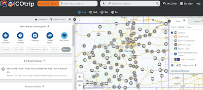
What is the Best Mobile App or Website To View CDOT Cameras Map?

What Is the best website or mobile app to view CDOT cameras Map? 

CDOT Cameras Map - on a browser or web app

Ultimate Guide to Design the Best Mobile App Navigation

Mobile App Navigation Examples

According to Statista, consumers are forecast to download 143 billion mobile apps from the Google Play store in 2026, up nearly 30 percent from the 111 billion apps downloaded in 2021.

It is not surprising because each of us today carries out actions on his smartphone using hundreds of mobile applications. When we need proven, safe, high-quality apps, we know we can find what we need in Google Play and the Apple App Store. But how convenient this application will be, we will learn only from experience.


This article is for you if you provide mobile application development services and want to create a high-quality application that will compete among hundreds of analogs.

Why is app navigation important?

Navigation in an application is one of the critical characteristics that determine the quality of an application. 


Navigation allows users to navigate from one application location to another. Navigating from one page to another or finding important content within an app makes it easy for users to interact with an app.

Navigation types

Various types of navigation can help users move between mobile screen apps.

1. Side navigation

Indicates navigation between screens that are in the same hierarchy.

2. Navigation forward

Forward navigation has three types of movement between the screens of any application to complete a task: down and forward.

3. Back navigation

It refers to moving backward between different screens. And it helps you navigate chronologically through the screen history or up the app hierarchy.


So why is it so important to have good app navigation? Navigation encourages users to explore all critical sections of the application.


Navigation is the source that will lead users to all the essential aspects of a mobile app.

Your users need a path in your app, but it must look promising enough to encourage users to choose the same! Proper navigation guarantees the same.

Four popular mobile app navigation patterns

1. Controversial hamburger menu

The concept of a burger menu is still vague and controversial in the design community. Some prefer it, while others want to exclude it from the design concept.

2. Floating navigation button

Oddly enough, floating icons are circular in shape and float around the interface. A floating action button (FAB) launches the main action in your mobile app's user interface.

3. Full-screen navigation

Full-screen navigation puts forward quite the opposite concept. If the designer uses full-screen navigation in an understandable way (getting rid of all the complexity), then it becomes pretty clear what needs to be explored to the user.

4. Tab navigation

Tab navigation appears at the top of Android apps and the bottom of iOS apps. A tab is usually a series of different options that lead users to the respective screen/page.

Conclusion

Why is there so much effort today to improve the app user experience? Forbes comments on the answer to this question: he writes that generation X and baby boomers use applications more purposefully. Gen Xers prefer personal connections to visual stimulation. 


On the other hand, Baby Boomers use apps to maintain a better quality of life. Both Gen Xers and Baby Boomers are very purposeful in their use of apps, so developers should put user experience (UX) as their top priority, ensuring that UX is seamless and easy to navigate.


Research your target audience, ensure you know how to work with them, and choose the type of mobile app navigation that will make you an industry leader. After all, it's not that difficult, along with the tips in this article.


Author’s bio: Anastasiia Lastovetska is a technology writer at MLSDev, a software development company that builds web & mobile app solutions from scratch. She researches the area of technology to create great content about app development, UX/UI design, tech & business consulting.

6 Car Upgrades to Improve Your Driving Experience

in dash apps navigation

If you’re a car enthusiast, then you’ve probably looked into making some upgrades to your vehicle. However, there are a lot of different options out there to choose from. How do you know what’s right for you? And what is really worth your money? 

Below, we are going to talk about six car upgrades that can improve your driving experience.


Interested in learning more? Then let’s get started.


Tires

Updating your tires is, without a doubt, one of the best changes to make to your vehicle. While it might not be the most exciting thing, it will make a big difference in your experience. From accelerating and braking to general driving performance, you really will feel more comfortable behind the wheel. Alongside this, you’re ensuring both yourself and your passengers’ safety.


Wheels

While you are changing your tires, you may as well look into upgrading the wheels as well. Most vehicles that come out of the shop generally have ones that are made of inexpensive material, which means they aren’t of high quality and aren’t reliable. Just make sure you do some research first. From size, design, bolt pattern, and color, there is a lot to take into consideration when deciding. 


Speaker System

Listening to good music and exciting podcasts can make a long trip much more enjoyable. By installing new car speakers, you can enjoy a cleaner sound to keep you occupied yet focused while driving. There are many different audio brands to choose from, so take a look around at the options and see what you like.  


Apps

Apps might not precisely be a “car upgrade,” but they are something you can install on your phone to improve your driving experience. From ones that help you find the cheapest gas to others that will locate the shortest possible route. They certainly will come in handy. You can find more information here. Just remember always to pull over if you plan on using your mobile phone. The last thing you want is to end up in an accident. 


Seat Covers

Seat covers are an affordable car upgrade that can make a big difference in the appearance of your interior. You’ll protect the upholstery from damage, and with the right design, you can alleviate pressure on your back. You’ll be more comfortable while you drive and will be maintaining its value for a more extended period of time. They really are worth the investment.


Exhaust

Finally, the last upgrade you might consider making to your vehicle is replacing the exhaust. Alongside giving it that nicer sound upon start-up, you’ll have extra power and improve your fuel economy. There certainly are many benefits that make it a wise choice, but it can still be a good idea to speak to a mechanic first to get a professional opinion on your current exhausts state.


And that’s it! What do you think? Are there are there any other upgrades that you would recommend to others?

When Will Google Maps Sync With Traffic Lights?


According to this article, Google is experimenting with showing traffic lights in Maps

Google Maps is experimenting with a new feature that displays traffic lights directly in Maps and assumes this will be for Waze also. Traffic lights will be visible both while navigating or simply browsing around.

This doesn't mean that the red lights, yellow lights, green lights will be displayed immediately.  It will likely just be a database of traffic lights and locations.  This is what it will look like below on Google Maps.


Real-time signals would be very cool.  There is a company called Connected Signals which connects the traffic signal to the cloud and will allow mapping companies to display and optimize traffic using these signals. 


Connect Signals has a product called Transit Signal Priority (TSP), automatic Pedestrian Signaling (PedSig), and a variety of other applications without requiring the acquisition and installation of additional capital infrastructure, including roadside equipment such as special-purpose optical or radio-frequency devices or DSRC installations. The system’s key innovations are its use of existing infrastructure (including the public cellular network and the city’s Traffic Management System (TMS) and traffic network) to securely provide these capabilities, its use of mobile devices to request action from the signal network, including pedestrian walk signals, and its software-defined nature that supports extension and modification of capabilities without requiring hardware modifications or field-service modifications.

How Does Google Maps Know Traffic?


Google Maps continually refreshes based on anonymously tracked user data in mobile apps, traffic light camera sensors & ALPR traffic cameras, and satellite data to make sure the app is displaying the most accurate traffic conditions possible.  Traffic data is also sourced by the wireless carriers AT&T & Verizon with vehicle data.  Ever wonder why your car is giving you free navigation data?  This is why because they are using your data to measure traffic.  What is ALPR

If you’ve ever used Google Maps, you’ve likely seen streets colored green, orange, or bright red if you live in a major city. Green roads mean traffic is moving normally (hardly ever), but orange and red represent slowdowns. Red slowdowns show up on the map when users in navigation mode are currently traveling at slower-than-usual speeds on that part of the road and are applied by Google automatically. However, once other divers using Google Maps are able to get through the area at higher speeds, Google will remove the slow down status for that location even if other users are still driving slower.

How Are Accidents & Slowdowns Reported? 

It’s unclear how many alerts are necessary for Google Maps or Waze to register it a slow traffic location or accident, but according to some experiments, it only took a single car driving faster to undo the traffic jam map status.

That said, it appears that Google Maps ignores when lots of users are at a standstill. Interestingly, not all vehicles are treated equally. Google Maps can tell the difference between a car, motorcycle, and other vehicles (at least in certain countries and regions). So even though a fast scooter might be able to weave its way through a traffic jam, Google Maps could—in some cases—recognize that the smaller vehicle’s movement doesn’t necessarily mean that regular traffic conditions have resumed.

Google Maps also updates traffic reports based on user input like Waze in addition to passive, anonymized location and movement tracking to help keep conditions updated.

Accidents, construction zones, speed traps, and other alerts can all be reported in Google Maps & Waze, and the more users that report an alert help it show up faster on the map for others and potentially help them avoid slowdowns and find better routes if necessary.  While in Google Maps’ navigation mode, tap the “+” icon (third icon down on the right-side menu). 

How Does Google Maps Reroute and Calculate Estimated Time of Arrival (ETA)

Google compares the speeds of its Google Maps users with speed limit information to calculate estimated arrival times. Basically, it takes how fast you’re actually moving, how fast you should be moving based on speed limits, how fast other drivers are going and adjusts how, and how much further you have on your route to determine your ETA.

Google Maps will also cross-reference user-reported conditions and other traffic data is monitors with your route and current speeds, and will adjust your arrival times if it notices a slowdown or other incidents along your route. Once the app has determined the severity and length of the slowdown, it will alert users whose routes are affected and suggest alternative directions if it’s ultimately faster.

Google Maps and Waze reroute suggestions aren’t always perfect, however. The algorithm can only respond to the most recent data and make a guess—it certainly can’t tell the future, either—so rerouting won’t always be faster (or necessary).  Read more about this study

Nokia Navteq Acquired Trapster in 2010

Pete Tenereillo, the founder of Trapster has apparently been acquired by Navteq / Nokia.  Navteq is a struggling  Chicago-based mapping company, that is a division of Nokia which is another struggling mobile phone maker that is quickly losing market share.  AutoBlog broke the news and said there were about five companies in the running and there was a bidding war for the company. The terms of the deal are not available. We are waiting to hear back from Nokia and Trapster.   

Pete is an engineer and a sports car enthusiast who founded the company to primarily help his fellow drivers slow down when police were near while driving through the roads of San Diego.  We met with Pete when shortly after he launched the application and only had a few hundred thousand users.  The company interested in working with us to verify our database of the fixed red light camera and speed camera locations.  We never licensed our database to Trapster but they suspiciously had most of the locations shortly thereafter.  It is not clear how they accumulated the locations in their database nor do we know how many they have. 

It has been wildly reported how many downloads they have for their application but no one ever seemed to know how many users they have on a regular basis to keep the data fresh.  The application has apparently received 9M downloads and is free.  It's very common for iPhone applications to have many downloads but a non-existent user base.   However, Trapster likely has many hundreds of thousands of users who share data, and it's impressive how they have scaled this capability as a small company.  

It's not clear if Trapster ever generated any subscription or advertising revenue from it but we don't think so. Trapster raised an angel round of fewer than one million dollars a few years ago and is based in San Diego.  We are not sure if they ever raised any more money than $1M or a VC round.  However, we would like to congratulate them on raising awareness about the application and accumulating so many users.  

As a disclaimer, we publish an open database of the fixed red light camera and speed camera locations and don't do a lot to prevent companies and people from copying it.  However, we are the largest database and most accurate database of red light cameras do date and no other companies have accepted our challenge to do a database comparison.  We do have a number of companies who license our database and are ethical about paying us for the data they use.  

It's great to see the company get acquired as there are several companies developing applications in Europe that are interested in coming to the US.  Europe has 40,000+ photo-enforced cameras and it's a much larger and more mature business over there.  The US currently has only about 6,000 cameras but it's growing at a rate of about 20% per year. 

However, it's important to note that my information might not be up to date, as corporate acquisitions and developments can change over time. To get the most accurate and current information, I recommend referring to reliable sources or conducting a search for the latest news and updates on Nokia's acquisitions and Trapster.

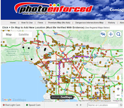
Live Traffic Cameras Mobile App

Photo Enforced Live Traffic Mobile App
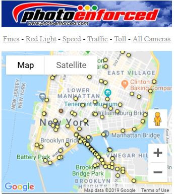
Live Traffic NYC Mobile Web App

Add Traffic Cameras Mobile App to Home Screen
How to Add Our Mobile Traffic Cameras App to Phone

red light cameras mobile app map of speed camera locations nearbyMap of traffic cameras nearbyFind toll road camera locations nearby
All of our maps are free mobile friendly pages that can be easily bookmarked on your phone using a Safari browser on the ihttps://www.photoenforced.com/Live-Traffic.htmlPhone and Chrome browser on an Android phone. These maps will never require a download and the home screen icon does nothing in the background unless you are using the app. Its like a shortcut to a browser but on your phone and the icon is easy to find and quick to use with no sign-in required. These maps are all advertising supported.

When you open the map it will automatically find your location and display data relevant to your area. Each map has its own unique icon depending on which data you are interested in. The default map is all cameras but you can choose speed cameras, red light cameras, traffic cameras below.

Here are details below on how to add to home screen.

How to Add Home Screen Ico

Should Uber Drivers Have Photo Enforced Warning Locations On Their Driving App?

The Uber Navigation Should Warn Drivers About Photo Enforced Locations
Submit Your Comments or Suggestions Below

What is NAVTEQ Worth To Nokia?


Nokia purchased NAVTEQ / Nokia (NYSE: NOK) for $8.1 billion dollars in 2007 when Nokia's stock was trading upwards of $30+ dollars per share.  Now Nokia's stock is trading at less than $6 per share and sinking.  Nokia's market cap is approximately $20B with annual sales of $55B.  When Nokia purchased Navteq it had a market capitalization of $120B.  So this begs the question of how much is NAVTEQ worth to Nokia these days?  It appears that NAVTEQ will do €600 million in revenue ($1B in US dollars) in 2011 while still losing money.

With Nokia struggling to get traction in the smartphone space it makes sense that NAVTEQ could be a ripe buyout candidate from a company like Microsoft or Apple who desperately need a map platform.  NAVTEQ products embedded in just about every car that has a navigation system embedded in the car.  Overprice I must say but the car manufacturers are selling the software for thousands of dollars when Google Maps is free.   Google Maps on the other hand is free but ad support and works great for most smartphone users.  Google Maps is not as reliable as NAVTEQ for navigation but it gets the job done at a fraction of the cost.  

Apple May Buy TomTom TeleAtlas to Compete with Google Maps

Apple Needs TomTom's TeleAtlas Maps to Compete with Google Maps

The iPhone and iPad manufacturer Apple might buy the GPS navigation firm TomTom / TeleAtlas as it needs its mapping assets to compete with Google Maps. Analyst Ben Wood is out with some interesting predictions for 2011, including one that cash-rich Apple (AAPL) will by GPS firm TomTom. Wood, formerly at Gartner, is a top wireless industry analyst, and I’m not just saying that so he returns my calls. Better yet, you could expect a wave of useful location-based features to reach MobileMe, third-party apps, and, of course, Apple's iAds system. And, of course, such a purchase could assist Apple should it decide to take a stab at the auto-electronics market.